Category Archives: Environmentalism

Kate Green, Watershed Line (2021)

a cement post

Credit: https://www.kate-green.co.uk/walks

“WATERSHED LINE

From May to September 2021

Kate is Artist-in-Residence in the Elan Valley.

The 1892 Water Act allowed Birmingham Corporation to purchase the watershed of rivers Elan and Claerwen. These 70 square miles would provide water to fuel the city’s industrial growth.

The WATERSHED LINE, the perimeter of the land claimed, was, and still is, marked by concrete posts.

https://www.elanvalley.org.uk/about/elan-links

Today, 81% of the Elan Estate is an Site of Special Scientific Interest (SSSI). Ironically, the economic value of its water has protected it from the use of pesticides and other chemicals, preserving habitats for now rare plants and animals. However, harnessing the natural cycle of these valleys was a feat of Victorian engineering that accelerated industrialization, contributing to the current global environmental crisis.

As a ‘post-industrial’ pilgrimage in a ‘wild’ landscape, my walk from POST TO POST is a conversation about the complexities of the human footprint.” [credit]

Rozalinda Borcila, Center for Getting Ugly – Kara Holland’s Walk to the Beach (2006)

“In a city built around the logic of automobility, a small group documents several attempts to walk to Tampa’s last remaining public beach. We rely on instructions from passers-by who struggle to conform their mental map of the city to the possibilities of walking.” [credit]

From the original invite: ”

Kara Holland invites participants on a walk from the Westshore Palms neighborhood to the beach located directly west, less than 1 mile away. This public beach is one of the last few remaining in the city of Tampa. We will try to get to the beach on foot, navigating terrain that, not unlike much of the city, is hostile to walking. The walk will explore the ways in which otherwise “benign” structures (a corporate park, a mall, the highway and so forth) are aggressive to bodies not trapped in cars and effectively colonize public space. Participants will pause to mark especially hostile boundaries, using materials found on site. We will share a picnic upon arriving at the beach, or wherever we can no longer travel on foot. Recording devices for documenting the walk are welcome and encouraged (cell phone, cell phone camera, digital camera, video camera, audio recorder, etc). This walk is a collaboration with The Center For Getting Ugly as part of the “Walk, Talk, Eat, Talk Some More” project.

Date: April 15, 4:30 pm
Meeting place: Kara’s apartment, 4601 Gray St. Tampa FL, 33609
Duration: 2 hours (??)” [credit]

“Center for Getting Ugly – dedicated to the research, practice and sustained experimentation with conflict as essential political activity. the Center seeks to develop individual and collective capabilities for the production of radical politics. must embrace conflict as an essential, productive aspect of collaboration. must be perpetually dissatisfied with, and suspicious of, existing aesthetic or semantic strategies.

The Center for Getting Ugly is dedicated to the research, practice and sustained experimentation of social conflict, with the goal of encephalizing collective organs and social technologies for the production of radical politics. In other words, the Center operates on the premise that, given sufficient practice, we can develop collective revolutionary organs. The Center is not a group, a project or a place, but an open infrastructure. Its various subdivisions target specific practices or arenas for the production of critical deviance, with collective activity as its main underlying principle.

The Center for Getting Ugly launches invitations, provocations. it facilitates collaboration between multiple practitioners. it imagines, invents and sometimes even deploys probing devices. currently, its subdivisions are:

Can’t we all just get along? Counter-Cartographies of Playing Nice – invited or self-appointed Special Fellows conduct research on dominant modes of subjectivation in various concrete situations. though not all maps take the form of two dimensional representations, the desire is to produce interpretive works which may be used to incite, illuminate or facilitate intervention.

Walking and not Walking – develops extended skill-sharing, experimental workshops specifically focused on walking practices – and, given the ways in which mobility is structured around consumption and other forms of subjectivation, on practices of not walking: standing, stopping, pausing, staying and occasionally lying down.

A Synchronized Swimming – Different collectives are invited to design an un-resolvable conflict equation based on their own, unique working methods. These equations are passed on to another collective, who develop interpretive extensions/models for the sustension of conflict. A Synchronized Swimming then dives into the Pool: an exhibition/symposium/forum for incorporating these models into action.”

SOURCES:

Dillon de Give, The Coyote Walks (2009-2017)

“An annual walking project that illustrates a connection between New York City and the wild. It was originally performed to commemorate the spirit of “Hal”, a coyote who appeared in Central Park in 2006 and died shortly after being captured and re-released in the forest. The walk begins in the city and remains within sight of a coyote-like path for three days before ending in a relatively wild area. The Coyote Walk has run as an itinerancy, or walking residency since 2014.” [credit]

“It is collaborative research, a retreat (in an almost literal sense), or a mindful holiday. Prospective fellow walkers may share an interest in related subjects, such as urban planning, folk/visual/movement/social arts, biology or other natural sciences. Participants must be prepared for a strenuous walk (approx. 15 miles per day) and for sleeping outside. Please note, differently abled walkers are encouraged to be in touch.” [credit]

Additional images and writing www.coyotewalks.wordpress.com

“I grew up in the Southwest US (Santa Fe, NM— where coyotes are ever-present both as biological entities and as cultural signifiers). I witnessed this event in the media while living in New York City, and continued to think about it in the years following. I began to feel that a larger narrative was looming behind the topical debates. The incident threw the relationship of the city dweller and the natural world into relief.  It wasnʼt an abstract suggestion of interconnection between the two; it was a (momentary) unmediated instance of collision– a moment of confusion for both. Hal disrupted a normal state of affairs by presenting himself as an embodiment of something external to our picture of daily life in an orderly civilization. In this he was as comedic as he was threatening. Was this a typical animal or an exceptional one? What was he thinking? And how, exactly, did he find his way into the city?

One way to try to understand this story was to guess about the geography of the journey.  The most obvious geographic challenge is the channel of water that separates the island of Manhattan from the mainland of the Bronx– like a moat surrounding a castle. Adrian Benepe, the NYC Parks Commissioner at the time, publicly hypothesized that Hal crossed a small Amtrack trestle bridge over the Spuyten Duyvil Creek at the northern tip of the Manhattan. This became a prevailing theory, but not the only possible one. Other scenarios were equally possible. For example, if Hal had utilized the long Bronx River corridor as a path, he might have crossed over the Harlem River further south and east. Because there were few eyewitness accounts, no camera traps, and no DNA analysis done on Hal, the definite crossing location will remain unknown. This crossing is a big plot point of the story as presented in the media. It came to stand for the dramatic moment in which a cunning trickster privately transgressed from the natural world into the human world. Looking closely at possible routes however, it becomes clear that there were many such crossings.

The Coyote Walks are fueled by curiosity about what it would mean to cross over the line between “the city” and “nature” oneself, to literally connect the two places. The walks are guesses about how coyotes enter New York City that are made with reverse human journeys out of the city. The project began as a kind of memorial to the incident— walked around the anniversary of Hal’s death and initially called the “laH” journey, a backwards spelling of the name. The Coyote Walk is now a time to pose questions about urban life and nature, to learn from the experience of stepping away from the city, and to consider walking practices (human and animal) as imaginative acts.” [credit]

Artist writing:

  • Unpacking (after) a coyote walk. Walking Lab residency, 2017. Link.

  • Connective filaments, coyote walks on the map. Living Maps Review No. 2, 2017.
    Link / Download PDF

  • Tracking the call of the wild from the heart of Manhattan. NYNJ Trailwalker Summer 2012. Download PDF

Speaking:

  • Artists and the Post Industrial Urban Wilderness, Union Docs, 2017. Link

  • Chance Ecologies Symposium, Queens Museum, 2016. Link

  • Re-inscribing the City: Unitary Urbanism Today, Anarchist Book Fair, 2011. Link

Referenced:

  • Urban Coyotes Spur Walks on the wild side. CUNY NYCity News Service. Audio piece by Samia Bouzid

  • “‘Uurga shig’ – What is it like to be a lasso?” Hermione Spriggs, Journal of Material Culture, 2016. Link

  • Out Walking the Dog blog, Melissa Cooper 2011-12. Link

  • City Reliquary event write up in Matt Levy’s Action Direction blog, 2009. Link

Andrea Carlson, You Are on Potawatomi Land (2021)

Andrea Carlson presented a site-specific large-scale (15’x266’) installation along the Chicago Riverwalk entitled, You Are on Potawatomi Land (2021). The sheer scale of the work required walking to take in the full text: “Bodéwadmikik ėthë yéyék – You are on Potawatomi land,” and it was situated on a recognized public walking space. The site of the work is near the former sandbar in the Chicago River that lends its name to the Sandbar Decision, a US Supreme Court case that “denied the Pokagon Band of Potawatomi ownership of the unceded land that was built into the lake by settlers.” In Carlson’s words, this work is “… meant to reaffirm Native people where they live and where they seem invisible, which is often the case in urban environments.”


Credits: Lee, JeeYeun. “Don’t Look to My Work for Reconciliation”: A Conversation with Andrea Carlson,” Monument Lab. Accessed February 13, 2022: https://monumentlab.com/bulletin/dont-look-to-my-work-for-reconciliation-a-conversation-with-andrea-carlson

Angela Ellsworth and Steven J. Yazzie, Museum of Walking (2014-)

[credit]

The Museum of Walking (MoW) is an artist led educational resource center committed to the advancement of walking as an art practice. MoW is an educational resource committed to people, land, action, and site through the everyday act of walking. Walking is a defining human activity with poetic and political resonance as well as mundane and ceremonial manifestations that play a central role in contemporary art, social and cultural history, health, and sustainable lifestyles. Whether alone or with a group, moving through space creates connections between people and the environment, as it promotes well-being and enhances creative divergent thinking.

MoW houses a small-but-mighty archive and library comprised of walking related material engaging disciplines of art, science, philosophy, health, activism, contemplation and cartography. Through workshops, exhibitions, experiences, and site-specific projects MoW fosters relationships between people, land, action, and place.

The Museum of Walking was founded in 2014 in 120 square foot space. As an itinerant museum we now reside in numerous places. “

Eve Mosher, Walking the Edge (2020)

map of NYC waterfront

[credit]

“Walking the Edge invites New Yorkers to reconnect to the diversity of the city’s shorelines and have a voice in the city planning process. Walking the Edge uses walking to encounter, reflect upon, and see places anew. Walking the Edge is a collaboration between arts organizations Culture Push and Works on Water with the NYC Department of City Planning. Due to Covid-19, we transitioned to online platforms for this project. See walkingtheedge.nyc for more information.”

Mother Earth Water Walk (2003-2017)

[credit]

“Two Anishinawbe Grandmothers, and a group of Anishinawbe Women and Men have taken action regarding the water issue by walking the perimeter of the Great Lakes.

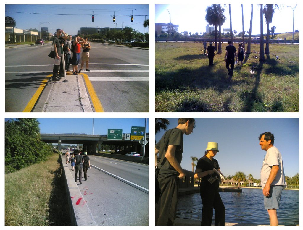
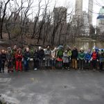
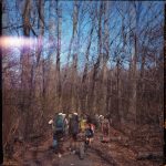
Along with a group of Anishinabe-que and supports, they walked around Lake Superior in Spring 2003, around Lake Michigan in 2004, Lake Huron in 2005, Lake Ontario in 2006 and Lake Erie in 2007.

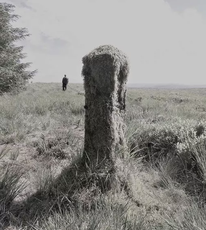
The 1st Annual Women’s Water Walk took place April 2003. Several women from different clans came together to raise awareness that our clean and clear water is being polluted by chemicals, vehicle emissions, motor boats, sewage disposal, agricultural pollution, leaking landfill sites, and residential usage is taking a toll on our water quality. Water is precious and sacred…it is one of the basic elements needed for all life to exist.

The Annual Women’s Water Walk was chosen for Spring because for the natural re-growth of our natural habitat, as it is a in time for renewal, re-growth, and re-birth.

A team of 6 – 8 Aboriginal people volunteer to walk and help with the everyday necessities such as having multitasked drivers to accompany walkers, food preparation, refreshment breaks, camp set ups, cleaners, laundry etc.

Public Relations Personnel have been involved throughout by taking shifts, and also going ahead to communities to aid with the awareness of the walk. This includes the distribution of media releases, posters, pamphlets, advertisements, and meeting and greeting of the participating walkers.

The overall result after implementation is to gather other groups and/or organizations to participate in an all regional walk around the Great Lakes. The goal is achieved strength in numbers with other Aboriginal men/women in the Great Lake Regions. The anticipated outcome is to have all people aware of the importance of the water and gain support and the gathering of other supporters whom would share an interest in protecting our water through our walk. This event will be annually, with the intent of the Women’s Water Walk to gain awareness and support for annual walks throughout the region. This will entail support, recognition, and awareness of the importance of keeping Great Lake waters clean.

It is anticipated that eventually challenges with other organizations to come together each spring to adopt a common like to care and protect from further pollution.

Stakeholder participation presently resides within the Biidaajiwun Local. Biidaajiwun Local is a women’s group run exclusively by women to raise awareness of issues, pertaining the needs of Aboriginal women. Contribution factors involve the housing of public relation workers, volunteers, support and the participation of several women sharing in the protection of our waters.

It is the hope that other locals, individuals and organizations will come together annually to spread interest and awareness in their communities. This annual event is intended to gain support to raise awareness throughout the region.

The originality of this idea is uncommon as there are few who are ready and willing to take on such a challenge. This idea is original because of how society today is taught to rely on the technological equipment, and that the mere thought of a walk being more than 15 minutes is a task for many. We strive our own determination that this challenge is seldom being done elsewhere, particularly in our region. We are doing this walk on our own beliefs within our own aboriginal culture and values of the importance of our waters is very precious and sacred to our being, as it is one of the basic elements needed for all life to exist.

In doing so, we know that such an endeavors requires a certain amount of funds to help carry the walk over for a two month period, but this alone will not prevent us from carry out what our grandfathers have predicted. Our waters will be scarce and will be deficient in the essential means for our survival….our water.”

Máiréad and Tim Robinson, Folding Landscapes (1972-)

a map

Tim Robinson “Oilerin Arann a map of the aran islands Co. Galway eire” (1996)

“Tim Robinson [1935-2020] is the alter ego of artist Timothy Drever whose abstract paintings and environmental installations were seen in a number of exhibitions in London before he moved to the west of Ireland in 1972. Robinson originally studied mathematics at Cambridge and worked as a teacher and artist in Istanbul, Vienna and London.

He and his wife, Máiréad [1934-2020], [then lived] in Roundstone in Connemara, where, in 1984, they established Folding Landscapes, a specialist publishing house and information resource center dealing with three areas of particular interest around Galway Bay: the Aran Islands, the Burren and Connemara. The maps and accompanying books are beautifully drawn and meticulously researched, explaining, often for the first time, the derivation and meaning of hundreds of place names and representing a wide range of information about the region’s culture and landscapes.

[They] gained much of this information literally on the ground, walking with naturalists, historians, archaeologists and other specialist through the landscape. [Their] maps and books provide an invaluable guide for visitors to the region as well as nourishing community spirit by identifying the irreplaceable uniqueness of the local environment and history. Tim and Mairead also run Unfolding Ideas, an annual Colloquium Series for scholars, educators and artists to engage in public talks, small group discussion and workshops in Roundstone, Connemara.”

Atul Bhalla, Yamuna Walk (2007)

a hiking path

[credit]

“Atul Bhalla’s digital slide presentation ‘Yamuna Walk’ is a photographic account of the four-day walk that the artist undertook along the banks of the Yamuna River which passes through his home town of New Delhi in India. The 53 km walk reveals how the river shapes the life of the city across its different zones. The images include some grand projects of civic engineering – four-foot wide overland pipes built on a vast scale. They also include the most ramshackle or absurd constructions, including a temporary kitchen built (if that is the word) on top of the pipes.

Bhalla’s walk captures contrasting aspects of modern India in all its beauty and brutality. Waste and breathtaking beauty sit side by side. Indeed, the work begins with a photograph of a riverbank covered with litter. Bhalla alerts us to the contradictions of polluting the natural resource that allows the city to exist. He also alerts us to the fact that, while it has a sacred character in the culture, being associated with rituals of purification, it is also used for refuse disposal. The river is the primary symbol of the divine – and yet it is treated in ways which would suggest the opposite.”

bags of marigolds on a walking path

Atul Bhalla, Yamuna Walk (2007)

Documentation of this walk is available as a photo book: “In Yamuna Walk, photographer and multimedia artist Atul Bhalla documents a five-day trek along the sacred Yamuna River as it passes through his home city of New Delhi, India.  Through his vivid and haunting photographs, Bhalla explores the myriad ways that modern life along the Yamuna is shaped by water, from the rural outskirts of the city to the polluted landscape of urban Delhi. Climbing over fences, crossing concrete overpasses, and navigating between blooming fields and piles of waste on his journeys, Bhalla also shows the diverse marks of human development that can be read in the image of the river.

Bhalla describes his practice as an attempt to understand water, the way he perceives it, feels it, drinks it, swims in it, and sinks in it. The personal and humanized but still mysterious Yamuna that emerges through his photographs sheds an unusual and compelling light on issues of water and the urban environment.”

Joe Bateman, Nomad’s Land (2010)

video stills of a performance

[credit]

“Joe Bateman’s expansive video works present the artist adopting the persona of a post­ apocalyptic survivor in a perfectly ordinary English landscape, roaming free. Without any machinery or means of transport, he walks everywhere on foot. He appears as a kind of tragic or sacrificial figure – the “ghost of the environment future”, perhaps. His anomalous behavior is meant to make us question our own.

For a large part of the work, every cue suggests that civilization has ended and only solitary hermits remain alive, scavenging for roadkill for sustenance. The picturesque landscape suggests that the character inhabits a rural and suburban version of the film ’28 Days Later’. Only some way into the work we realize that, with the protagonist excepted, life continues unabated – albeit invisible to him.

The work recalls the philosopher Giorgio Agamben’s best-known book Homo Sacer: Sovereign Power and Bare Life of 1998. Agamben and Bateman allow us to imagine what unadorned ‘bare life’ might yet look like when the fossil fuels under our feet are exhausted. At this point, when production grinds to a halt, our cities will become uninhabitable and we will be forced to give up the idea that we control the planet, rather than vice versa. Bateman’s character also resembles Agamben’s description of Roman criminals whose punishment was to be excluded from all society and have their rights as citizens revoked. Their exclusion meant they became sacred men (‘homo sacer’), akin to holy fools.”

a man crawling and eating

Joe Bateman, Nomad’s Land (2010)