Category Archives: Borders

Bani Abidi, Security Barriers A-Z (2009-19)

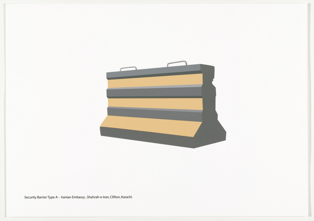
illustration of a road barrier

Ban Abidi, “Security Barriers A-Z” – type A – Iranian Embassy, Shahrah-e-Iran, Clifton, Karachi (CREDIT)
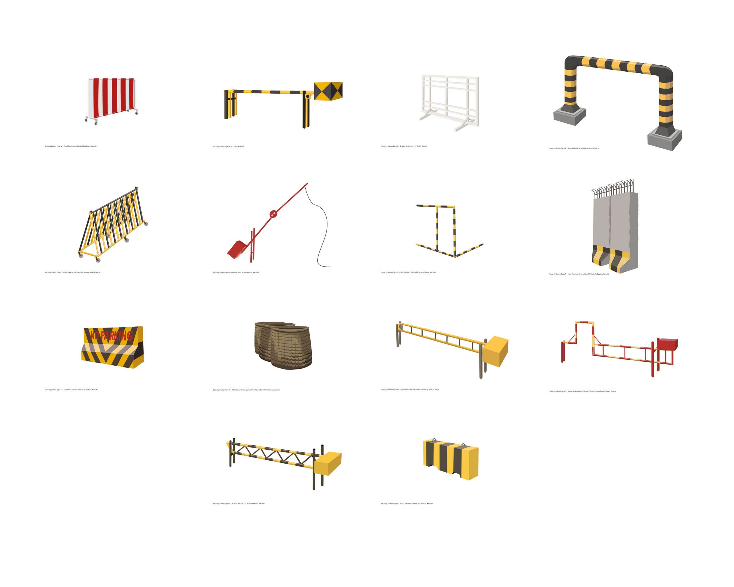
illustation of security barriers

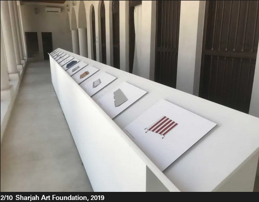
Bani Abidi, Security Barriers A-Z (selection of M-Z; 2019) [CREDIT]
Bani Abidi, (1971-) in Karachi (PK), lives and works in Karachi and Delhi (IN)

26 Inkjet Prints, 29.7 x 42.0cm

A design typology of security barriers found on the streets of Karachi (2009 – 2019). These barriers, which started making an entry into Karachi’s streets soon after the attack on the Twin Towers in NY in September 2001, raise questions around the notion of safety and economic segregation, state control and political strategies of demarcation. Out of context, against a white background, they resemble minimalist abstractions.” [credit]

Security Barriers A-L, 2008

The artist Bani Abidi is a nomad of two cultures. Born and brought up in Karachi, Pakistan, she lives and works today in Delhi, India. These biographical details run through her humorous works that depict the cultural and political differences and similarities between the two countries and their conflict-ridden border. In her work Security Barriers A-L, Abidi employs temporary architectural elements for an analysis of political manifestations of state violence, the maintenance of state power, and national strategies of demarcation.
In twelve prints, the artist catalogs the various models of security barriers in her hometown of Karachi, which she first photographed on-site, before going on to digitally rework them. She found the various constructions in front of embassies, consulates, at airports and intersections. Arranged in rows of three, the brightly colored, clear, and sharply contoured vector drawings against a white background are like objects featuring in a glossy catalog. One almost feels tempted to order one of these beautiful objects for the front yard, even though their design idiom is unambiguously that of a barrier. Only the attached titles establish the link to their original context and the related strategies of isolation and demarcation: type H stands out among the drawings with its all too vigorous expression of political superiority, while the flower-bedecked barrier in front of the British Deputy High Commission of the former colony almost seems smarmy. (KB) [credit]

“Bani Abidi’s early engagement with video, beginning at the Art Institute, led to the incorporation of performance and photography into her work. These mediums have provided Abidi with potent, sometimes subversive means to address problems of nationalism—specifically those surrounding the Indian-Pakistani conflict and the violent legacy of the 1947 partition dividing the two countries—and their uneven representation in the mass media. She is particularly interested in how these issues affect everyday life and individual experience.” (credit)

“…It is the life of ordinary citizens that interests Abidi—not the heroic tale, but the poetry of the quotidian struggle for freedom of those who die laughing, or defiantly laugh in the face of death….

I want to make a strong point about the fact that my work is not about Pakistan. It’s about power, security, and militarised architecture; and it’s about the vulnerability of regular people.

We ought to be aware and assert the fact that such an identity-based reading of culture only happens when a work by a brown person is shown in a white space. A romance set in Paris is never perceived as being ‘about’ France, is it? What you see in my films is what I know and assume as my normative: the sounds, smells, landscape, and temperature . . . these are the details that help tell a story.

I am certainly not out to teach anyone anything about my country. My practice draws from a large spectrum of present and past experiences, and I hope to be able to speak to anyone who is interested in those ideas.

Of course, there are many layers in my work and its reading very much depends on the context in which it is placed….” (credit)
Brett Stalbaum and others, Walking Tools (2009-10)

By Patrick Dow

Walking Tools is a project undertaken by Angela Black, Nichol Bernardo, Micha Cardenas, Cicero Silva, Steve Durie, Chris Head, Atom Leonhart, Todd Margolis, Jason Najarro, Chloe Sanossian, and lead by Brett Stalbaum, academics from the University of California San Deigo (UCSD) in which they used a loose confederation of software and related art and/or education projects across various languages, platforms and disciplines to share standards for content delivery and management of Global Positioning Satellite (GPS) data (by defining an XML schema extension to the standard GPX schema), allowing media and other data to be associated with GPS data.” Source: http://www.walkingtools.net/?page_id=2

Fostered under the umbrella of the walkingtools.net website and “brand” (owned and controlled by Brett Stalbaum and UCSD as an open source software project), the supporting software for the project is titled the Walkingtools Reference APIs. (III A iv 14) Brett Stalbaum was the primary software architect and programmer for this project, which began in 2007 in collaboration with Cicero Silva, currently of the Federal University of Juiz de Fora, Brazil. The HiperGps/HiperGeo project is actually three different related softwares.

The first part is software that runs on inexpensive mobile phones that can direct a user on a tour of points of interest in a geographic area. It uses map and compass metaphors depending on GPS, and is capable of playing audio and displaying an image at the locations chosen by authors. This software was partially developed and first tested in a workshop with New Zealand students during the SCANZ 2009 Raranga Tangata Artist Residency (III A iii 28) in conjunction with the education program at at the Puke Ariki Museum Library in New Plymouth,on the West Coast of the North Island of New Zealand, from January 26th to February 8th 2009. The end result was a project titled the “Pukekura Park Demonstration/Environment and Sustainability GPS Tours.” (Section III A iv 1)

The second part of the software was developed for numerous workshops held in Brazil in 2009, including the 41st Winter Festival in Diamantina, Minas Gerais, hosted by the Federal University of Belo Horizonte (Section III A iv 2) and a Workshop titled “Locative Media: Theory and Practice” at the FILE Festival in Sao Paulo. (Section III A iv 3.) Another workshop was later held at UCSB. (Section III A iv 4). This software is a GUI for normal Mac/Windows/Linux desktops that facilitates producing content for mobile phones.

Essentially, it is a deployer for the mobile phone software (see above), allowing students to take latitude and longitude values, images, audio files and easily combine them into compiled bundles of mobile phone software that can then be loaded on a handset for use. The software allows non-technical creators to produce locative narrative tours for standard java mobile phones, and is especially targeted at beginning or casual users.

Brett Stalbaum has regularly assigned a project using this software in VIS40/ICAM 40 during the 2009/2010 academic year, where it helps facilitate a number of key skills. To produce a HiperGps project it is required that students learn to edit both images and audio files, and that the students conceptualise and plan an artistically interesting self-guiding audio tour of the UCSD campus, and ultimately deploy it to an actual mobile phone and demonstrates their work for critique.

Students have produced work ranging from the serious the to silly, from the simple to the sublime, and from the shortsighted to the significant. But they are introduced to emerging locative media art-making practice in a short three week assignment, all because HiperGps abstracts the normally highly technical computer programming tasks into simple actions taken in a familiar graphical user interface language designed to be easy to use. The project was in fact motivated by Brett Stalbaum and Cicero Silva’s desire to quickly introduce students to the practice of locative media in a practical way.

An important document that Brett Stalbaum authored is a manual that lays out HiperGps uses and techniques that is used in his classes. (III A i 5) Overall, this project represents the central piece of his educational research, and has proven to be a success in his teaching.

The third part of the software consists of a server-side web application that currently allows two activities. First, users of the HiperGps GUI could use it’s HiperGeo features to upload their tours to a web server. Second, features of the HiperGps application itself can contact that service and search for another’s content in the mobile phone user’s current location, download and “play” that content, creating a context for sharing.

The first version of these server features was implemented during a few weeks in residence at the Edith Russ Site for Media Art, Oldenburg, Germany, in the summer of 2009. That software was part of the exhibition Landscape 2.0 that took place from August 29 through November 15, 2009 in Oldenburg, and where the public was first able to interact with and create/share their own mobile narratives. (See also nice Catalog at III A ii 5.) In addition, and based on a commitment to include undergraduates in research, HiperGps/HiperGeo’s role in theLandscape 2.0 exhibition was supported through a CALIT2 Summer Internship Program in which recent graduate Nichole Benardo helped with design and some web programming tasks. Another student involved in HiperGps/HiperGeo related work was Anubhav Chorpa, who worked on starting a parallel iPhone SDK version of the mobile software for two quarters of CSE 199 special studies.

Other professional accomplishments were related to the Transborder Immigrant Tool project, which is multi-researcher effort out of the B.A.N.G. Lab led by Ricardo Dominguez at CALIT2. Brett Stalbaum’s research contributions to that project have been directed toward software development and testing, culminating in 2010 with a working demonstration version of a public safety software platform including software for mobile phones and desktop computer. The mobile code is in part based on the Walkingtools Reference APIs (III A iv 14).

The idea was to provide the location of water stations in the along the Mexico-USA border by linking the information to mobile phones. The project is considered controversial by many within the conservative US establishment who accused members of encouraging and promoting illegal immigration. This caused some members of the project to be investigated by the UCSD and the UCSD Police Department. Source: http://www.walkingtools.net/Brett Stalbaum however maintains the project is an attempt to save lives, and prevent the unnecessary deaths of those attempting to enter the US illegally by crossing the deserts that line the US-Mexico border, who will still attempt to cross into the US regardless.

As part of our in situ research, I have built relationships with water station activists which has provided valuable feedback on the software design, and I now regularly volunteer filling water stations with Water Station Inc. The fully functional, working proof-of-concept source code for the mobile Transborder Immigrant Tool was officially released for public examination this summer, when presented by myself during a talk titled “Briefing on Transborder Immigrant Tool Source Code and Persecution of Professor Ricardo Dominguez” at Critical Code Studies @ USC (Critical Code Studies at the University of Southern California Conference) July 23, 2010. (II E 35). Other public presentations include: CIANTEC SÃO PAULO, Congresso Internacional Artes, Novas Tecnoloecnologias e Comunicação conference at Universidade MacKenzie, São Paulo, Brazil, Thursday September 18th 2008 (II E 31), and to the VOSMOB research group led by François Bar (Voces Móviles / Mobile Voices project,[1] ) at the University of Southern California, Thursday March 26th 2009 (II E 32), as well as in a group poetry reading at City Centered, a festival of locative media and urban community sponsored by KQED Public Media and Gray Area Foundation for the Arts at KQED studios, San Francisco June 11-13. Some of the highlights of the robust media coverage of the project were mine and Ricardo Dominguez’s appearance on KPBS radio’s “These Days” morning talk show program, hosted by Maureen Cavanaugh. on January 11th 2010 (III. B 27), and in an invited editorial “Academics make statement with project”, in the San Diego Union Tribune co-written by project leads Micha Cárdenas, Amy Sara Carroll, Ricardo Dominguez and myself, March 7, 2010.

The project has also received curatorial attention being included in prominent regional and statewide art exhibitions surveying the work of contemporary artists. The Transborder Immigrant Tool featured in both the “Here Not There: San Diego Art Now” at the Museum of Contemporary Art La Jolla, Jun 06, 2010–Sep 19, 2010, and the “2010 California Biennial” at the Orange County Museum of art Oct. 24 to March 13. I produced custom demo versions of the sofware designed to run on mobile phones mounted on the gallery walls.

I think the radio interview mentioned above could be useful for a more general understanding too.

Source: Brett Stalbaum’s electronic corresspondance August 2010.A video is available:

Link to AP Video on Transborder Immigrant Tool Project

http://www.youtube.com/v/L58Kjq4aHsM&color1=0xb1b1b1&color2=0xd0d0d0&hl=en_US&feature=player_embedded&fs=1“>

People most associated with the walkingtools HipeGps project are: Cicero Silva and myself, assisted by Nichol Bernardo.

TBtool: Ricardo Dominguez, myself, (Co-PIs) and Amy Carroll, Jason Najarro, Chloe Sanossian, Micha Cardenas, and Elle Mehrmand.

Link to New Media wiki home

Link to timeline of new media artworks” (credit)

Judy Marsh, Left Leaning (2017)

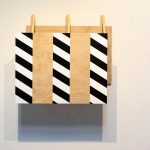
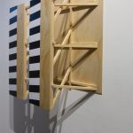
“Judy Marsh’s paintings use the visual language of the structures that shape our movement in the urban environment, particularly of hazard signs and barriers. In these sculptural paintings strips of black and white diagonal stripes protrude forwards with an arresting vibrancy. Left open at the side, the works invite the viewer to peer between the panels – filled with carefully executed scaffolding, these sections speak to the in-between spaces that emerge when two barriers are erected.” (credit)

Ken Johnston, Our Walk to Freedom

Walk to Freedom came about in late 2017 after I discovered the National Civil Rights Museum in Memphis, Tennessee was planning remembrance ceremonies in April 2018 to mark the 50th anniversary of Dr. Martin Luther King, Jr.’s assassination. I recognized the importance of this moment and I thought about how could I contribute to this great event.

I asked myself what could I do to honor the legacy of Dr. King’s ideas? What commitment of myself could I offer the Civil Rights movement today? How could I pay homage to our ancestors who sacrificed so much for our freedom?

That’s when the idea of Walk to Freedom was born. I realized if I was going to offer a symbolic gesture to Dr. King, move the Civil Rights movement ahead by one yard, give thanks to the original Freedom Seekers, then I was going to walk to demonstrate my commitment.” (credit)

Johnston has completed several walks and that timeline is listed here.

Bill Gilbert, Walk to Work (2009)

“For twenty-two years I have made the hour long drive from my house in Cerrillos to my office at the University of New Mexico. For this piece, I decided to walk to work. I strapped on a backpack, headed out my door and walked as straight a line as possible (given the variations in topography, land ownership, etc.) to my office at UNM. Along the roughly 50 mile trek across ranch land, the Sandia Mountains and the northeast quadrant of Albuquerque I recorded my perceptions from the perspective of a lone hiker walking across the land.

This work is part of a series of “Physiocartographies.” Started in 2003 in the field with the Land Arts of the American West mobile studio, the physiocartographies  series combines the abstraction of cartographic maps with the physical act of walking the surface of the planet to create portraits of place. In the various works from this series I follow prescribed paths across the landscape using a gps unit to navigate and record points, a camera to shoot images and a digital recorder to capture sounds. The final works appear as reconstructed maps, videos and installations.” (credit)

Hiwa K, Pre-Image (Blind as the Mother Tongue) (2017)

Single channel HD video, 17:40 mins

“Work Description

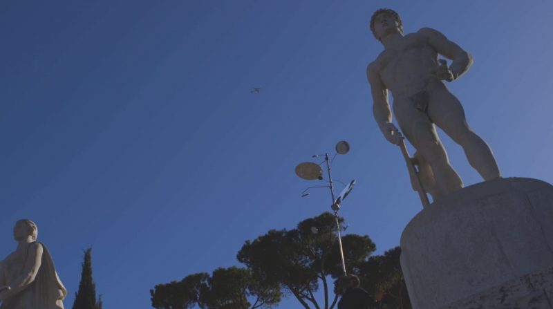
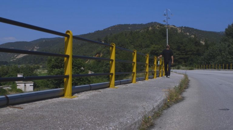
Pre-Image (Blind as the Mother Tongue) re-traces a journey undertaken on foot by Hiwa when he fled Iraqi Kurdistan in the mid-1990s. This long and often dangerous journey — lasting five months and two days and passing through Iran, Turkey, Greece, France and Italy — was an “experience of space and time” and a “fracturing of spatial and cultural experiences.” Each point along the way, whether a city or town, was experienced fractally, and always from below — with no overview.

In this work, the artist uses an adapted balancing device, equipped with motorcycle mirrors, to re-create the disorienting experience of space and time experienced by so many making similar journeys. One mirror reflects what is ahead, another behind, while the others reflect the artist and his immediate surroundings. To walk forward he must balance and control the device, alluding to the effort needed to keep moving and recalibrate oneself to new contexts.

Artist Biography

Hiwa K (b. 1975) Lives and works between Sulaymaniyah, Iraqi Kurdistan, and Berlin, Germany.Working across video, performance and installation, Hiwa’s work draws from personal experiences, including family anecdotes, his path through arts education, and daily encounters and occurrences.

Hiwa K’s works have been included in group exhibitions including Documenta 14, Kassel (2017); 56th Venice Biennial curated by Okwui Enwezor (2015); Asian Art Biennial, Taipei (2019); 21st Contemporary Art Biennial Sesc Videobrasil, Sao Paulo (2019); Anren Biennale, Sichuan (2019); Yinchuan Biennale (2018); and MOMA Ps1, New York (2019).

Recent solo exhibitions include: Kunsthalle Mannheim (2019); S.M.A.K. Museum, Ghent (2018); KW Institute of Contemporary Art (2017) and KOW Gallery, Berlin (2016). His work has been awarded the 2019 Hector Preis and in 2016, both the Arnold Bode Prize and the Schering Stiftung Art Award.” (credit)

Alex Villar, Temporary Occupations (2001)

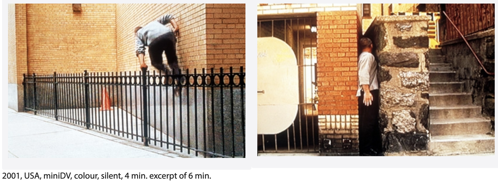
man jumping fences and fitting into narrow passages

Alex Villar, Temporary Occupations, 2001, USA, miniDV, colour, silent, 4 min. excerpt of 6 min.

“Drawing from interdisciplinary theoretical sources and employing video-performance, installation and photography, I have developed a practice that concentrates on matters of social space. My interventions are done primarily in public spaces. They consist in positioning the body of the performer in situations where the codes that regulate everyday activity can be made explicit. The body is made to conform to the limitations of claustrophobic spaces, therefore accentuating arbitrary boundaries and possibly subverting them. A sense of absurdity permeates the work, counterpoising irrational behaviour to the instrumental logic of the city’s design.
Theoretical references cover the extensive work done on the problematic of space, especially the works of Foucault and de Certeau, which describe panopticon and heterotopic spaces as well as the potentialities for everyday re-writings of urban space. Aesthetic traditions foregrounding my work go from the sixties and seventies performative-based sculpture and installations by Hélio Oiticica, Lygia Clark and Cildo Meirelles, to the urban strategies of the Situationists and the anarchitecture of Gordon Matta-Clark. Like the in-between activities it seeks to investigate, my work lives between various fields: part nomadic architecture, part intangible sculpture and part performance without spectacle.

Temporary Occupations from alex villar on Vimeo.

Temporary Occupations depicts a person running on the sidewalk in New York while ignoring the city’s spatial codes and therefore resisting their effects upon the organization of everyday experience. The clips in the video register situations of temporary invasion and occupation of private spaces located in a public setting. The action simply articulates the continuity of these spaces with the remaining areas from which they were extricated, drawing attention to, and possibly subverting, the boundaries that demarcate them.
This piece is part of a long-term investigation and articulation of potential spaces of dissent in the urban landscape, which has often taken the form of an exploration of negative spaces in architecture.” (credit)

Tim Brennan, Roman Runner: Limes Germanicus I (2013)

Brennan’s current project – one might almost call it a campaign – entitled ‘Roman Runner’ involves the artist envisaging running the entire circumference of the Roman Empire. To date, he has traversed Hadrian’s Wall and the Antonine Wall as ultra-marathon manoeuvres.

“Tim Brennan, Roman Runner: Limes Germanicus I (2013)

Tim Brennan has ran more than 90 miles across The Netherlands in 19 hours as part of his major performance art project to trace the edge of the Roman Empire across the globe. He completed a solo run along the edges of the Roman Empire in Continental Europe, which he began at 3am on Saturday (August 24) taking the road east from Katwijk- Aan-Zee, on the edge of the North Sea to Herwen-De-Bijland, near the German border and the Black Sea, known as the Lower Germanic Limes (frontier).” (credit)

Saleh Khannah, In Between Camps (2012)

A more recent walking artwork highlighting the intersection of walking and race is In Between Camps (2012), which consisted of a group of six researchers and artists, Ismael Al-bis, Fabio Franz, Matteo Guidi, Thayer Hastings, Ibrahim Jawabreh, Saleh Khannah, Sara Pelligrini, Giuliana Racco, and Diego Segatto, walking across the West Bank from the springs of al-Arroub to Solomon’s Pools (three massive stone reservoirs) south of Bethlehem in search of an ancient Roman waterway, the Arrub Aqueduct. The project originated from the Campus in Camps program developed by Al-Quds University, an experimental education program in the Palestinian refugee camp of al-Dheisheh. The purpose of the project was to both reactivate the water system’s source, and imagine a time-frame before the contemporary apartheid-reality of walls, colonial land parceling, and occupation of Palestine. While they were hiking, the group was stopped by Israeli soldiers who were suspicious of the Palestinian participants due to their skin tone and dress. The international participants intervened and explained the trip, their search of the aqueduct, and showed them the map, engaging in a type of information overload tactic, not unlike the tactics Codogan described for minimizing the perception of criminality. After the walk, the group created a booklet (Booklet ) reflecting on the history of the site, their experience, and how the various layers of race-based rule and exclusion are projected on the land.

Hastings, Thayer. “Tracing a Line Through a Fractured Palestine, from al-Arroub to Bethlehem,” Walking Art / Walking Aesthetics. Accessed May 16, 2022: https://walkingart.interartive.org/2018/12/thayer-palestine

Michael Belmore, Coalescence (2017)

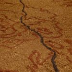
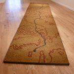
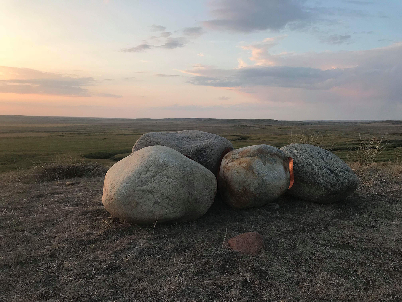
“Michael Belmore’s Coalescence was conceived as a single sculpture in four parts, [as part of LandMarks2017/ Repères2017 invites people to creatively explore and deepen their connection to the land through a series of contemporary art projects in and around Canada’s National Parks and Historic Sites from June 10-25, 2017.]. Sixteen stones, ranging in weight from 300 to 1,200 pounds, are fitted together and inlaid with copper, then situated to frame the vast distance between the southernmost boundary of the Laurentide Ice Sheet near Grasslands National Park in Saskatchewan, to one of its points of drainage into Hudson Bay in Churchill, Manitoba.

stone with copper

Sites in Riding Mountain National Park and The Forks National Historic Site, both in Manitoba, punctuate the stones’ migration. Together, the four locations mark meeting points between water and land: ancient shorelines, trade routes and meeting places, sites of annual mass migrations of animals, as well as the forced displacement of peoples.

Belmore uses copper as a way to invest the stones with labour and value. The stones come against each other to create a perfect fit, while their concave surfaces move apart slightly to reveal the warm glow of copper to reflect light. Each crevice is filled with a fire that will be extinguished with age, turning brown, then black, and reaching a luminous green hue as it settles into the landscape. They are a marker of how everything comes from the ground and returns to it, and how these processes stretch far beyond human understanding of time.

Belmore has created a moment of connection between deep geological time of stone and the linear human time of labour. On the occasion of the 150th anniversary of Confederation, this connection acts as a reminder of how the timelines of national celebration do not take into account the timelines of the land on which they take place. The stones were going to traverse a land familiar with rising and falling waters to reach their locations, but spring 2017 brought a record snowstorm and a spring melt that washed out the rail line that serves as the main transport artery between Churchill and southern Manitoba.

The political negotiations that followed have left the responsibility for its repair unresolved — part of the continued legacy of colonialism, the challenges of northern transportation and migration, and the importance of international trade routes that go back to Canada’s first trading posts. Belmore’s piece remains intact in Churchill, its splitting and migration halted by the processes that reach out from its conceptual core.” [credit]