Category Archives: Architecture

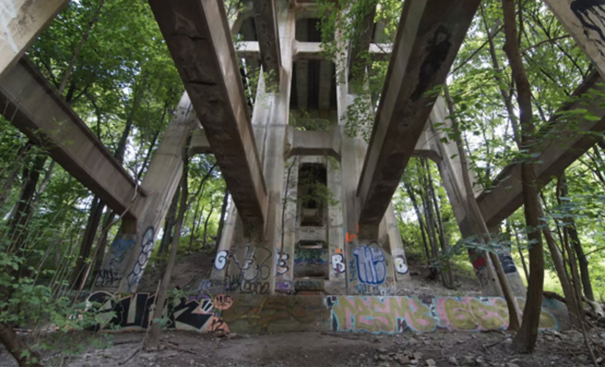
Graeme Miller, Linked (2003-)

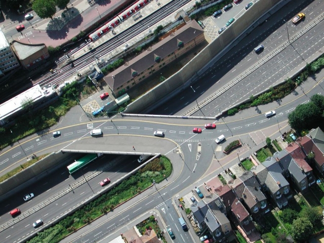
aerial view of a roadway

Graeme Miller, Linked (2003-)

“Commissioned by the Museum of London, Graeme Miller’s ongoing Linked project opened in July 2003 as a massive semi-permanent sound work and off-site exhibition of the contemporary collection of the Museum of London.

Stretching across from Hackney Marshes to Redbridge, the M11 Link Road was completed in 1999 after the demolition of 400 homes, including Miller’s own, amid dramatic and passionate protest. Concealed along the three-mile route, 20 new transmitters continually broadcast hidden voices, recorded testimonies and rekindled memories of those who once lived and worked where the motorway now runs evoking a cross-section of East London life. Day and night, voices and music were broadcast along the length of the route.

IN RECOVERY

Linked has endured as perhaps the largest sonic installation and sculptural entity in London for over 18 years. Since 2003 its transmitters have broadcast over a million times the voices of former residents of the 500 buildings demolished to build the M11 Link Road motorway.

Over these years some of the transmitters have been lost – to a lorry crashing into a lamppost, to accidentally being taken down by contractors, to weather, time and entropy. Amazingly many have endured and have become an almost secret layer of the landscape of East London. It is not only time to refurbish this work, but time to look at how it works in time and how public art endures or de-commissions itself. With this in mind Graeme Miller is currently looking to stage RE-Linked in 2022: the first annual 48-hour restoration of the entire network that will also include a reflective public conversation between former residents, interviewees and interviewers, sound and radio artists, eco-activists and, as ever, the wider curious walking public.

Please watch this space for developments and join us in 2022

“I found myself wishing that more of Britain was covered by such transmissions, ghosts of ravaged neighbourhoods set free to speak again.”

Libby Purves, The Times” (credit)
Bani Abidi, Security Barriers A-Z (2009-19)

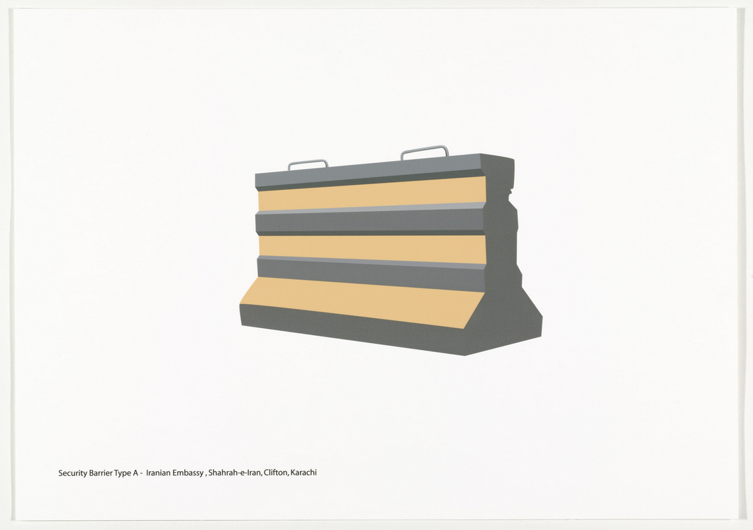
illustration of a road barrier

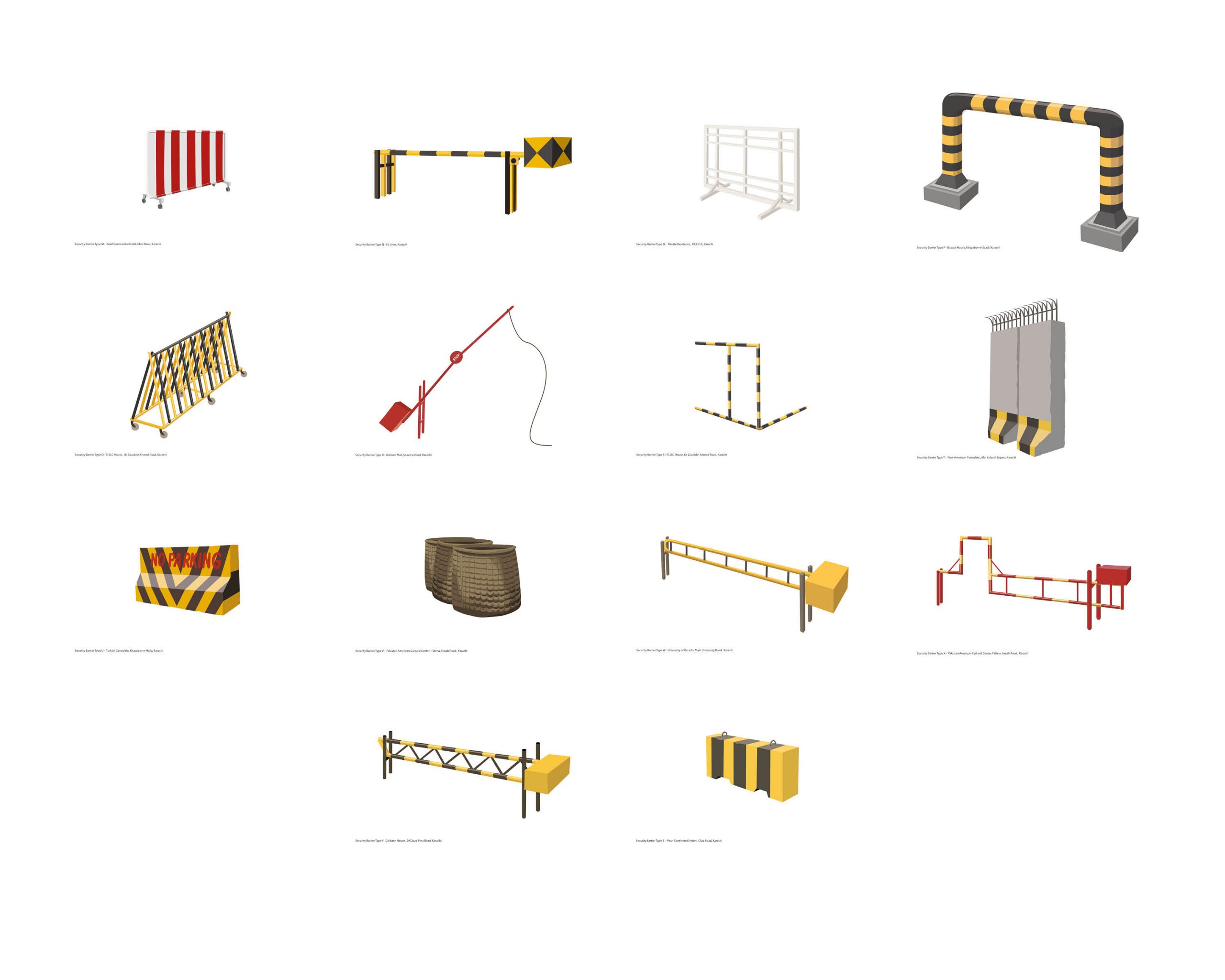
Ban Abidi, “Security Barriers A-Z” – type A – Iranian Embassy, Shahrah-e-Iran, Clifton, Karachi (CREDIT)

illustation of security barriers

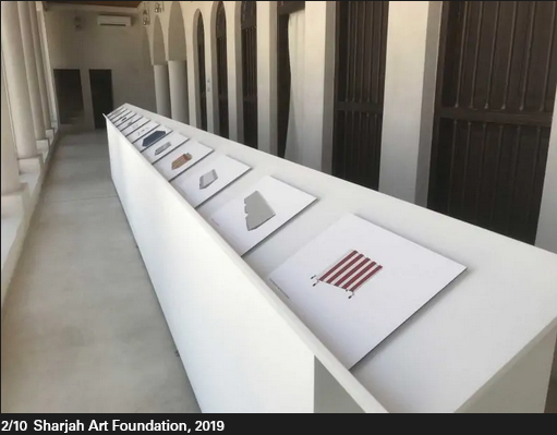
Bani Abidi, Security Barriers A-Z (selection of M-Z; 2019) [CREDIT]

Bani Abidi, (1971-) in Karachi (PK), lives and works in Karachi and Delhi (IN)

26 Inkjet Prints, 29.7 x 42.0cm

A design typology of security barriers found on the streets of Karachi (2009 – 2019). These barriers, which started making an entry into Karachi’s streets soon after the attack on the Twin Towers in NY in September 2001, raise questions around the notion of safety and economic segregation, state control and political strategies of demarcation. Out of context, against a white background, they resemble minimalist abstractions.” [credit]

Security Barriers A-L, 2008

The artist Bani Abidi is a nomad of two cultures. Born and brought up in Karachi, Pakistan, she lives and works today in Delhi, India. These biographical details run through her humorous works that depict the cultural and political differences and similarities between the two countries and their conflict-ridden border. In her work Security Barriers A-L, Abidi employs temporary architectural elements for an analysis of political manifestations of state violence, the maintenance of state power, and national strategies of demarcation.
In twelve prints, the artist catalogs the various models of security barriers in her hometown of Karachi, which she first photographed on-site, before going on to digitally rework them. She found the various constructions in front of embassies, consulates, at airports and intersections. Arranged in rows of three, the brightly colored, clear, and sharply contoured vector drawings against a white background are like objects featuring in a glossy catalog. One almost feels tempted to order one of these beautiful objects for the front yard, even though their design idiom is unambiguously that of a barrier. Only the attached titles establish the link to their original context and the related strategies of isolation and demarcation: type H stands out among the drawings with its all too vigorous expression of political superiority, while the flower-bedecked barrier in front of the British Deputy High Commission of the former colony almost seems smarmy. (KB) [credit]

“Bani Abidi’s early engagement with video, beginning at the Art Institute, led to the incorporation of performance and photography into her work. These mediums have provided Abidi with potent, sometimes subversive means to address problems of nationalism—specifically those surrounding the Indian-Pakistani conflict and the violent legacy of the 1947 partition dividing the two countries—and their uneven representation in the mass media. She is particularly interested in how these issues affect everyday life and individual experience.” (credit)

“…It is the life of ordinary citizens that interests Abidi—not the heroic tale, but the poetry of the quotidian struggle for freedom of those who die laughing, or defiantly laugh in the face of death….

I want to make a strong point about the fact that my work is not about Pakistan. It’s about power, security, and militarised architecture; and it’s about the vulnerability of regular people.

We ought to be aware and assert the fact that such an identity-based reading of culture only happens when a work by a brown person is shown in a white space. A romance set in Paris is never perceived as being ‘about’ France, is it? What you see in my films is what I know and assume as my normative: the sounds, smells, landscape, and temperature . . . these are the details that help tell a story.

I am certainly not out to teach anyone anything about my country. My practice draws from a large spectrum of present and past experiences, and I hope to be able to speak to anyone who is interested in those ideas.

Of course, there are many layers in my work and its reading very much depends on the context in which it is placed….” (credit)

Girolamo Frigimelica, Villa Pisani Maze (1721)

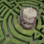
A renaissance maze in Italy

Local lore holds that the hedge maze at Villa Pisani is so challenging, Napoleon was lost in it when he lived in the villa, and Hitler and Mussolini were too chicken to go into it at all.

The maze is a classic medieval circular path with nine concentric repeating patterns and many dead ends surrounding a small tower in the center. It was designed by Girolamo Frigimelica for the Venetian Doge Alvise Pisani in 1720 as part of the beautifully landscaped grounds which surround the 114 room villa which was to be built 15 years later. The challenge comes from the hedges, which are so high that it is impossible to see over once you have entered. A statue of Minerva, goddess of wisdom and arts, holds court from the top of the central tower reached via a double spiral staircase.

Pisani was a wealthy landowner with several estates in the area. He became the 114th Doge of nearby Venice in 1735, possibly the inspiration for the 114 rooms in the villa. He served for only six years before his death in 1741, ruling during the declining, hedonistic days of the Venetian Republic. There would be only six more Doges before it fell in 1797.

Villa Pisani is an elaborate property by any comparison. Building began in 1735 in Baroque style, with its huge rectangular house surrounded by 30 acres of gardens dotted with follies, a Versailles-like reflecting pool, a petite hill-top ice house, a miniature forest, an orangery, and false hills, not to mention the labyrinth. Inside, the walls are painted with allegorical murals of cavorting Greek gods and celebrations of the Pisani family, as well as trompe l’œil effects on ceilings and walls.

It was seized by Napoleon in 1807 following his conquest of Venice, and given to his stepson Eugene Beauharnais (at which time the emperor may or may not have gotten lost in the labyrinth), and was later used by Hitler and Mussolini for talks in 1934. The villa is now empty, but open to visitors.” (credit)

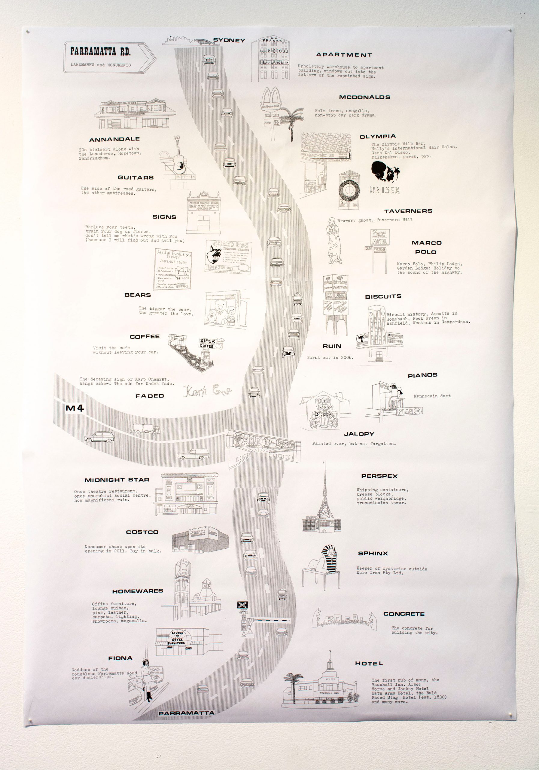
Vanessa Berry, Parramatta Road: Landmarks and Monuments (2014)

“In the map of Parramatta Road created by Vanessa Berry, quintessential Parramatta Road features like car dealerships and teddy bear stores are elevated to the status of hallowed landmarks. Author of the book Mirror Sydney, and the blog of the same name, Berry explores and reflects the city with the eyes of someone who has traversed it, many times, and looked with intent at the fine details of its fabric and features.” (credit)

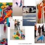
A.L. Steiner + robbinschilds, with AJ Blandford + Kinski, C.L.U.E. (color location ultimate experience), (20017-Present)

“C.L.U.E. (color location ultimate experience) is a collaborative video, installation and performance work by artists A.L. Steiner + robbinschilds, with AJ Blandford and Seattle-based band Kinski. The performance and installation-based works have been presented in exhibition and performance venues internationally. The video works range from a single-channel piece (C.L.U.E., Part I), to multichannel pieces, up to 13-channels. ” (credit)

Modelab, Ghost Walker (2014-15)

“Like photography negatives, urban design comprises information on what is not visible and only can be inferred by its contours. In this manner, urban geography becomes a catalogue of defeats and absences that can be interpreted from what once existed.

Based on Mexico City maps from 1867 and 1892, superposed on a 2014 Google map of the Juarez and Cuauhtémoc neighbourhoods, this project seeks to create an appropriation of histories through an artistic and scholar exploration of a specific street that ceased to exist more than a century ago.

Following the techniques of the Situationist’s dérive and Andrei Monastyrsky’s work with the Collective Actions Group, Ghost Walker: An Impossible Walk Through Mexico City’s History is a longitudinal study of a specific urban space, witness of a myriad of processes and modifications throughout 150 years

Ghost Walker (2014-15) has been presented at Muca Roma in Mexico City (2016), and as part of the group exhibition “Walk With Us” at the Rochester Arts Center (2022).

Participants: Sandra Calvo, Ramiro Chaves, Erick Meyenberg, Raul Ortega Ayala, Sergio Miranda Pacheco, Manuel Rocha Iturbide, Modelab.

DOWNLOAD PUBLICATION

Modelab is an artistic initiative aiming to promote interdisciplinary projects at the intersection of public space, history, and cartography.

Formed in 2014 by Claudia Arozqueta and Rodrigo Azaola, Modelab projects have taken place in streets, parks, billboards, beaches, museums, vacant retail stores, and other spaces in Australia, New Zealand, France, Mexico, Taiwan, and the Philippines.” (credit)

Sebastián Díaz Morales, Pasajes IV (2013)

“Sebastián Díaz Morales (1975-), Pasajes IV, Digital video / HD format / 22’40 min on 5:30 hs loop / 2013, 32’’ monitor; Character: Maya Watanabe

This idea follows the same narrative, concept and structure as of former Pasajes video series.
In the so far three Pasajes video works a similar formula repeats on different backdrops: a character unites places through gateways, doors, stairs and roads which would be naturally disconnected from each other. This is the geography of a story expressed in an alteration to the normal, which so far aroused from a montage of urban spaces.

In this proposed formulation of Pasajes the video explores the landscape of Patagonia.
Crisscrossing this territory in the search of the differences on the landscape, a character as a guide, unites different territories disconnected in its geography, as essential pieces of a puzzle to understand this region’s present.” (credit)

Amish Morrell, Henri Fabergé, Christine Atkinson, Epic Ravine Marathon (2015)

ravine

ravine

“On November 15, 2015, more than thirty people, including artists, adventure racers, casual joggers, track champions, walkers and other members of the general public, ran from Old Mill subway station in Toronto to Sherbourne subway station, following four major urban watersheds. The route followed the Humber River from Bloor Street to the Black Creek, crossed the North York hydro corridor north of Finch Avenue, joined the West Don River and followed the main artery of the Don River to the finish at Bloor Street, passing under Highway 401 twice. Covering fifty-five km in total, the route took more than 9 hours and almost entirely followed riverbanks and ravine trails. Two people finished the entire distance.”

Credit: Morrell, Amish and Diane Borsato. Outdoor School: Contemporary Environmental Art. Douglas and McINtyre, 2021. Page 62.

“Toronto’s ravine system provides city-dwellers with an urban oasis that’s not often explored. But on Sunday, a small group of Torontonians will run a day-long marathon through these expansive green spaces.

Organizer Amish Morrell, who’s the editor of C Magazine, says these runs aren’t competitive. “It’s not a race at all, it’s really an adventure.”

Morrell notes that his friend and performance artist Henri FabergĂŠ started doing conceptual running routes a few years ago. Together, along with artist Jon McCurley, they ran from Kipling to Kennedy (35 kilometres above ground).

About a year ago, Morrell mapped out a marathon route through Toronto ravines – areas that he regularly explores and runs through. He even cross-country skies the ravines in the wintertime. “A lot of this kind of evolved out of finding different ways of moving through the city,” he says.

For Sunday, he’s planned a 55 kilometre trek between the Black Creek, Finch Hydro Corridor and Don River sections of the ravine. “I would say 90 per cent of it is trail in the ravines and about 50 per cent of that is totally kind of secret, clandestine paths,” though Morrell stresses that the event may not be for everyone.

“It’s a pretty DIY, kind of punk event,” he says. Anyone who decides to join needs to be well-prepared with proper equipment and supplies – a detailed list can be found on the Epic Ravine Marathon Facebook page.

And, don’t expect a timed race. “Our motivations are more about exploration, curiosity, discovering places and learning things about them,” says Morrell. He knows the distance may be daunting and expects many of those who join his small group will tag along for the first 10 to 15 kilometres.

Morrell says that while most of the route is accessible via the TTC, being the in the ravines provides an alternate way to view Toronto. “It totally shifts and transforms your experience of the city.”

Photo by Kevin McBride in the blogTO Flickr pool.” (credit)

Hock E Aye Vi Edgar Heap of Birds, Most Serene Republics (2007)

Hock E Aye VI Edgar Heap of Birds, (Cheyenne/Arapaho, 1954-)

This work was a temporary memorial for Native Americans who died in Italy as part of Buffalo Bill Cody’s Wild West Show in the late nineteenth century, and was installed at the Venice Biennale in 2007. It consisted of a series of 16 outdoor signs to remember and honor their loss, 8 outdoor signs that serve as commentary, several signs in the water-taxis encouraging repatriation of the Native people’s bodies from Europe to the U.S., as well as a large billboard at the Venice airport that stated ‘welcome to the spectacle, welcome to the show’ as a faux welcoming sign, which was visible as people walked through the airport check point. These Lakota warriors were formerly imprisoned in the U.S. and were given the choice to remain in prison, or go perform in Europe, which was not much of a choice.