Category Archives: Activism or Protest

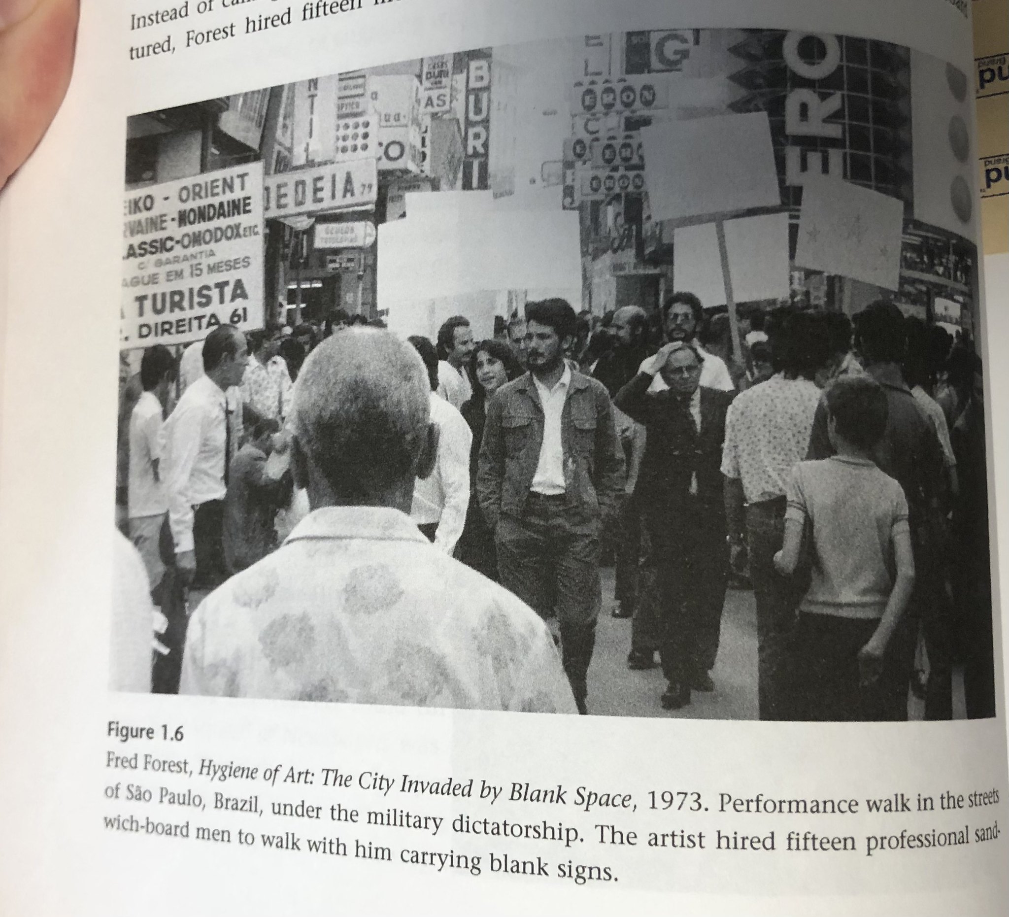
Fred Forest, Hygiene of Art: The City Invaded by Blank Space (1973)

book containing photo of protestors with blank signs

Fred Forest, Hygiene of Art: The City Invaded by Blank Space (1973). Photo of page from “Walking and Mapping: Artists as Cartographers”

This was a performance walking by Fred Forest in the streets of São Paulo, Brazil under the military dictatorship. The artist hired 15 professional sandwich board men to walk with him carrying blank signs.

The goal of this series of provocative actions undertaken under the cover of art was to create symbolic/utopian spaces of popular free expression in the mass media and the street in defiance of the ruling military junta. Elements included a nationwide call-in operation using specially installed telephone lines, blank spaces for reader response published in several newspapers, the use of radio and television to orchestrate unusual experiments in public participation (e.g. a taxi rally through the streets of the city), a videographic “mini museum of consumerism,” and a street demonstration in which participants carried blank signs: “The City Invaded by Blank Space.” This last endeavor led to the artist’s arrest by the political police.” (credit)

12th SAO PAULO BIENNIAL
OCTOBER 1973-
AWARDED THE BIENNIAL’S GRAND PRIZE IN COMMUNICATION

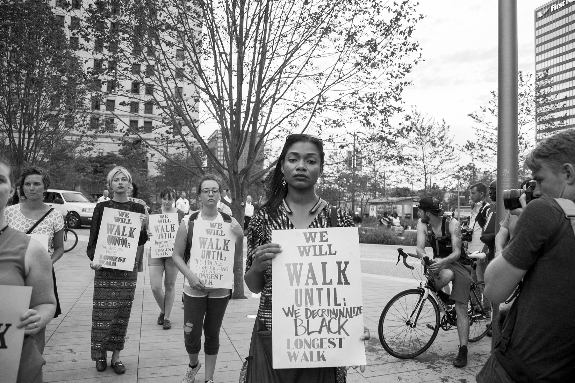
Megan Young “Longest Walk” (2016)

Developed in response to the militarization of public space during the 2016 Republican National Convention (RNC), this embodied installation draws inspiration from feminist histories and solidarity networks around the word. The collaborative gesture includes serial public texts printed by Angela Davis Fegan and collective actions led by female participants. Gallery installations include the resulting print archives layered with experimental video archives of participants in motion.

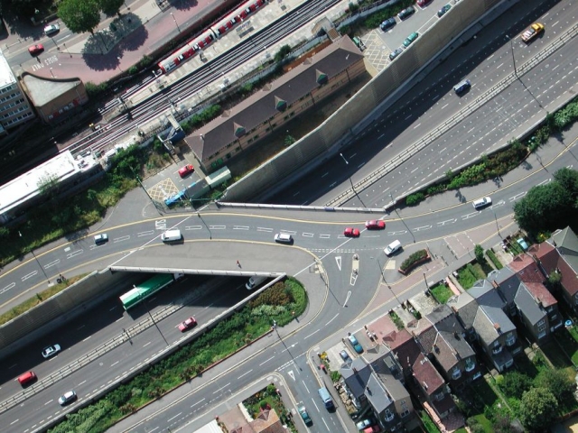
Graeme Miller, Linked (2003-)

aerial view of a roadway

Graeme Miller, Linked (2003-)

“Commissioned by the Museum of London, Graeme Miller’s ongoing Linked project opened in July 2003 as a massive semi-permanent sound work and off-site exhibition of the contemporary collection of the Museum of London.

Stretching across from Hackney Marshes to Redbridge, the M11 Link Road was completed in 1999 after the demolition of 400 homes, including Miller’s own, amid dramatic and passionate protest. Concealed along the three-mile route, 20 new transmitters continually broadcast hidden voices, recorded testimonies and rekindled memories of those who once lived and worked where the motorway now runs evoking a cross-section of East London life. Day and night, voices and music were broadcast along the length of the route.

IN RECOVERY

Linked has endured as perhaps the largest sonic installation and sculptural entity in London for over 18 years. Since 2003 its transmitters have broadcast over a million times the voices of former residents of the 500 buildings demolished to build the M11 Link Road motorway.

Over these years some of the transmitters have been lost – to a lorry crashing into a lamppost, to accidentally being taken down by contractors, to weather, time and entropy. Amazingly many have endured and have become an almost secret layer of the landscape of East London. It is not only time to refurbish this work, but time to look at how it works in time and how public art endures or de-commissions itself. With this in mind Graeme Miller is currently looking to stage RE-Linked in 2022: the first annual 48-hour restoration of the entire network that will also include a reflective public conversation between former residents, interviewees and interviewers, sound and radio artists, eco-activists and, as ever, the wider curious walking public.

Please watch this space for developments and join us in 2022

“I found myself wishing that more of Britain was covered by such transmissions, ghosts of ravaged neighbourhoods set free to speak again.”

Libby Purves, The Times” (credit)

Bani Abidi, Security Barriers A-Z (2009-19)

illustration of a road barrier

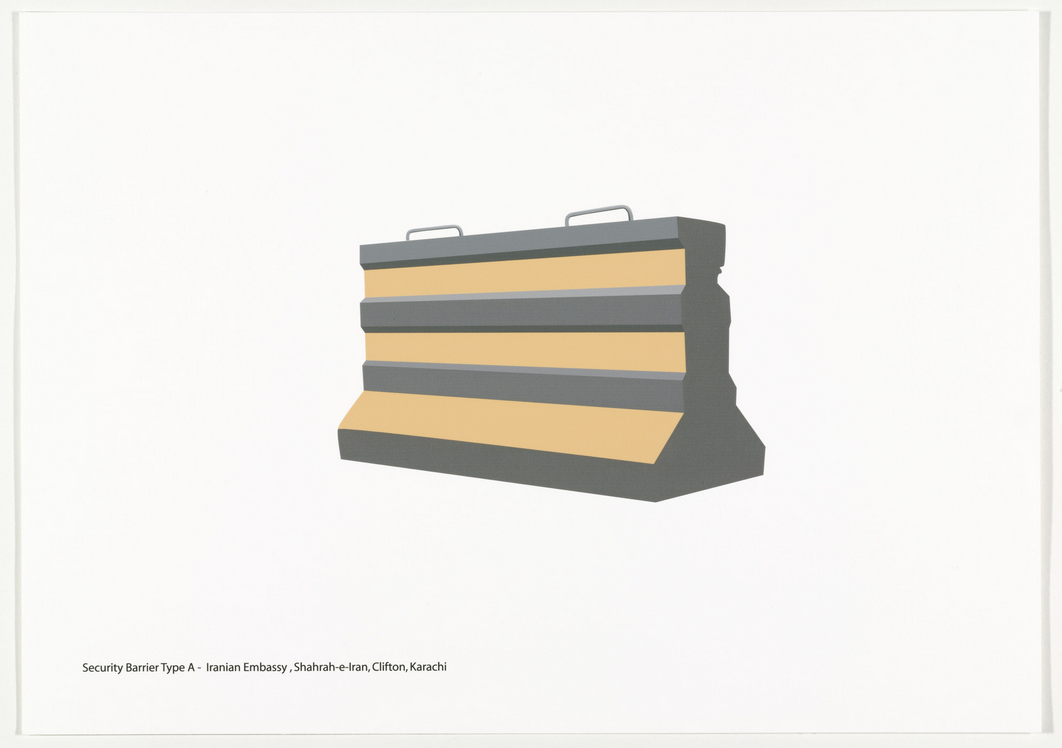
Ban Abidi, “Security Barriers A-Z” – type A – Iranian Embassy, Shahrah-e-Iran, Clifton, Karachi (CREDIT)

illustation of security barriers

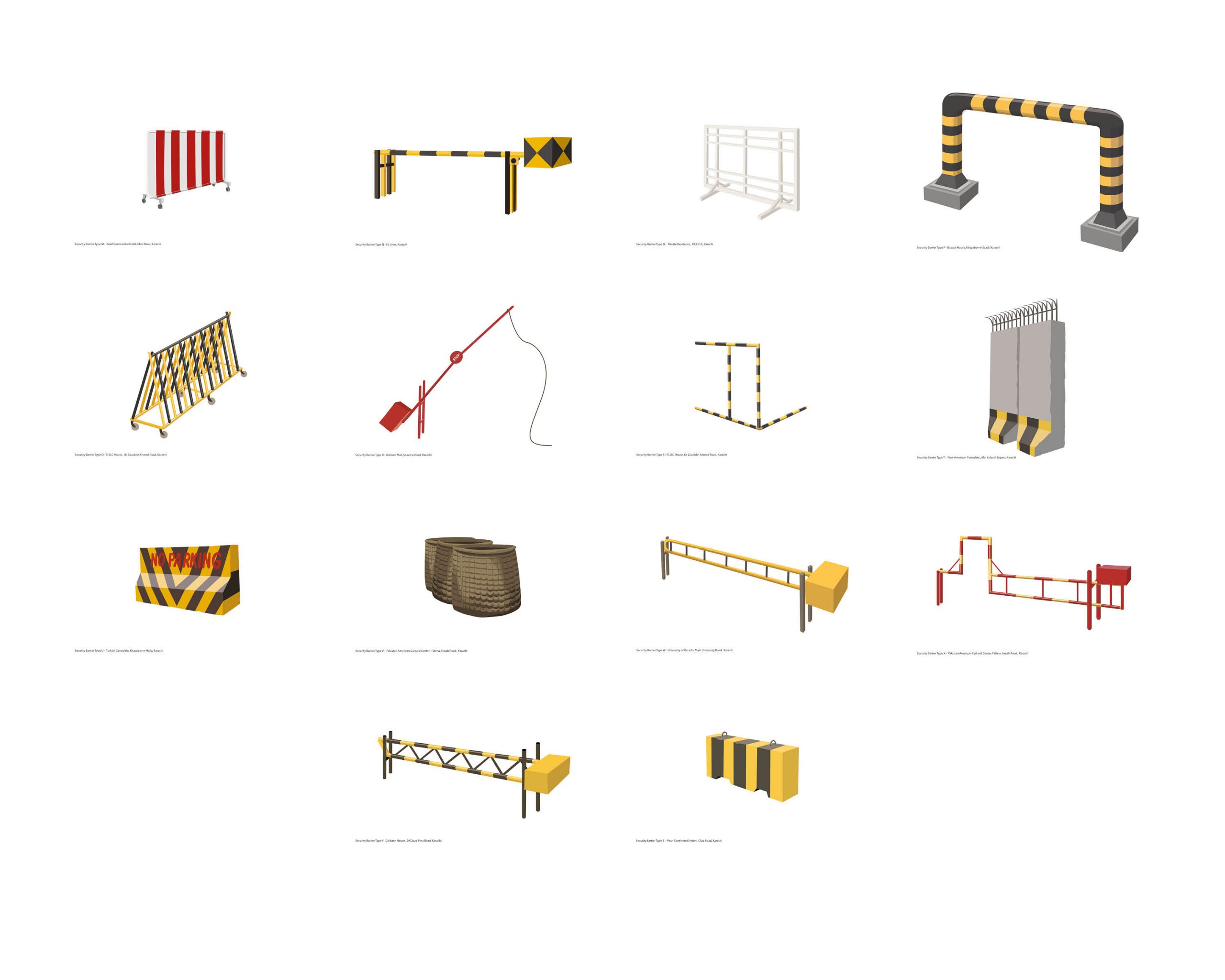
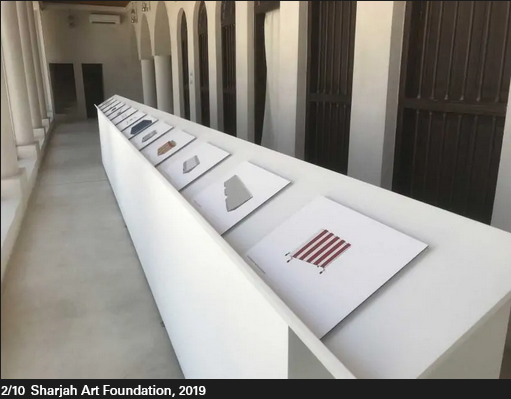
Bani Abidi, Security Barriers A-Z (selection of M-Z; 2019) [CREDIT]

Bani Abidi, (1971-) in Karachi (PK), lives and works in Karachi and Delhi (IN)

26 Inkjet Prints, 29.7 x 42.0cm

A design typology of security barriers found on the streets of Karachi (2009 – 2019). These barriers, which started making an entry into Karachi’s streets soon after the attack on the Twin Towers in NY in September 2001, raise questions around the notion of safety and economic segregation, state control and political strategies of demarcation. Out of context, against a white background, they resemble minimalist abstractions.” [credit]

Security Barriers A-L, 2008

The artist Bani Abidi is a nomad of two cultures. Born and brought up in Karachi, Pakistan, she lives and works today in Delhi, India. These biographical details run through her humorous works that depict the cultural and political differences and similarities between the two countries and their conflict-ridden border. In her work Security Barriers A-L, Abidi employs temporary architectural elements for an analysis of political manifestations of state violence, the maintenance of state power, and national strategies of demarcation.
In twelve prints, the artist catalogs the various models of security barriers in her hometown of Karachi, which she first photographed on-site, before going on to digitally rework them. She found the various constructions in front of embassies, consulates, at airports and intersections. Arranged in rows of three, the brightly colored, clear, and sharply contoured vector drawings against a white background are like objects featuring in a glossy catalog. One almost feels tempted to order one of these beautiful objects for the front yard, even though their design idiom is unambiguously that of a barrier. Only the attached titles establish the link to their original context and the related strategies of isolation and demarcation: type H stands out among the drawings with its all too vigorous expression of political superiority, while the flower-bedecked barrier in front of the British Deputy High Commission of the former colony almost seems smarmy. (KB) [credit]

“Bani Abidi’s early engagement with video, beginning at the Art Institute, led to the incorporation of performance and photography into her work. These mediums have provided Abidi with potent, sometimes subversive means to address problems of nationalism—specifically those surrounding the Indian-Pakistani conflict and the violent legacy of the 1947 partition dividing the two countries—and their uneven representation in the mass media. She is particularly interested in how these issues affect everyday life and individual experience.” (credit)

“…It is the life of ordinary citizens that interests Abidi—not the heroic tale, but the poetry of the quotidian struggle for freedom of those who die laughing, or defiantly laugh in the face of death….

I want to make a strong point about the fact that my work is not about Pakistan. It’s about power, security, and militarised architecture; and it’s about the vulnerability of regular people.

We ought to be aware and assert the fact that such an identity-based reading of culture only happens when a work by a brown person is shown in a white space. A romance set in Paris is never perceived as being ‘about’ France, is it? What you see in my films is what I know and assume as my normative: the sounds, smells, landscape, and temperature . . . these are the details that help tell a story.

I am certainly not out to teach anyone anything about my country. My practice draws from a large spectrum of present and past experiences, and I hope to be able to speak to anyone who is interested in those ideas.

Of course, there are many layers in my work and its reading very much depends on the context in which it is placed….” (credit)

Brett Stalbaum and others, Walking Tools (2009-10)

By Patrick Dow

Walking Tools is a project undertaken by Angela Black, Nichol Bernardo, Micha Cardenas, Cicero Silva, Steve Durie, Chris Head, Atom Leonhart, Todd Margolis, Jason Najarro, Chloe Sanossian, and lead by Brett Stalbaum, academics from the University of California San Deigo (UCSD) in which they used a loose confederation of software and related art and/or education projects across various languages, platforms and disciplines to share standards for content delivery and management of Global Positioning Satellite (GPS) data (by defining an XML schema extension to the standard GPX schema), allowing media and other data to be associated with GPS data.” Source: http://www.walkingtools.net/?page_id=2

Fostered under the umbrella of the walkingtools.net website and “brand” (owned and controlled by Brett Stalbaum and UCSD as an open source software project), the supporting software for the project is titled the Walkingtools Reference APIs. (III A iv 14) Brett Stalbaum was the primary software architect and programmer for this project, which began in 2007 in collaboration with Cicero Silva, currently of the Federal University of Juiz de Fora, Brazil. The HiperGps/HiperGeo project is actually three different related softwares.

The first part is software that runs on inexpensive mobile phones that can direct a user on a tour of points of interest in a geographic area. It uses map and compass metaphors depending on GPS, and is capable of playing audio and displaying an image at the locations chosen by authors. This software was partially developed and first tested in a workshop with New Zealand students during the SCANZ 2009 Raranga Tangata Artist Residency (III A iii 28) in conjunction with the education program at at the Puke Ariki Museum Library in New Plymouth,on the West Coast of the North Island of New Zealand, from January 26th to February 8th 2009. The end result was a project titled the “Pukekura Park Demonstration/Environment and Sustainability GPS Tours.” (Section III A iv 1)

The second part of the software was developed for numerous workshops held in Brazil in 2009, including the 41st Winter Festival in Diamantina, Minas Gerais, hosted by the Federal University of Belo Horizonte (Section III A iv 2) and a Workshop titled “Locative Media: Theory and Practice” at the FILE Festival in Sao Paulo. (Section III A iv 3.) Another workshop was later held at UCSB. (Section III A iv 4). This software is a GUI for normal Mac/Windows/Linux desktops that facilitates producing content for mobile phones.

Essentially, it is a deployer for the mobile phone software (see above), allowing students to take latitude and longitude values, images, audio files and easily combine them into compiled bundles of mobile phone software that can then be loaded on a handset for use. The software allows non-technical creators to produce locative narrative tours for standard java mobile phones, and is especially targeted at beginning or casual users.

Brett Stalbaum has regularly assigned a project using this software in VIS40/ICAM 40 during the 2009/2010 academic year, where it helps facilitate a number of key skills. To produce a HiperGps project it is required that students learn to edit both images and audio files, and that the students conceptualise and plan an artistically interesting self-guiding audio tour of the UCSD campus, and ultimately deploy it to an actual mobile phone and demonstrates their work for critique.

Students have produced work ranging from the serious the to silly, from the simple to the sublime, and from the shortsighted to the significant. But they are introduced to emerging locative media art-making practice in a short three week assignment, all because HiperGps abstracts the normally highly technical computer programming tasks into simple actions taken in a familiar graphical user interface language designed to be easy to use. The project was in fact motivated by Brett Stalbaum and Cicero Silva’s desire to quickly introduce students to the practice of locative media in a practical way.

An important document that Brett Stalbaum authored is a manual that lays out HiperGps uses and techniques that is used in his classes. (III A i 5) Overall, this project represents the central piece of his educational research, and has proven to be a success in his teaching.

The third part of the software consists of a server-side web application that currently allows two activities. First, users of the HiperGps GUI could use it’s HiperGeo features to upload their tours to a web server. Second, features of the HiperGps application itself can contact that service and search for another’s content in the mobile phone user’s current location, download and “play” that content, creating a context for sharing.

The first version of these server features was implemented during a few weeks in residence at the Edith Russ Site for Media Art, Oldenburg, Germany, in the summer of 2009. That software was part of the exhibition Landscape 2.0 that took place from August 29 through November 15, 2009 in Oldenburg, and where the public was first able to interact with and create/share their own mobile narratives. (See also nice Catalog at III A ii 5.) In addition, and based on a commitment to include undergraduates in research, HiperGps/HiperGeo’s role in theLandscape 2.0 exhibition was supported through a CALIT2 Summer Internship Program in which recent graduate Nichole Benardo helped with design and some web programming tasks. Another student involved in HiperGps/HiperGeo related work was Anubhav Chorpa, who worked on starting a parallel iPhone SDK version of the mobile software for two quarters of CSE 199 special studies.

Other professional accomplishments were related to the Transborder Immigrant Tool project, which is multi-researcher effort out of the B.A.N.G. Lab led by Ricardo Dominguez at CALIT2. Brett Stalbaum’s research contributions to that project have been directed toward software development and testing, culminating in 2010 with a working demonstration version of a public safety software platform including software for mobile phones and desktop computer. The mobile code is in part based on the Walkingtools Reference APIs (III A iv 14).

The idea was to provide the location of water stations in the along the Mexico-USA border by linking the information to mobile phones. The project is considered controversial by many within the conservative US establishment who accused members of encouraging and promoting illegal immigration. This caused some members of the project to be investigated by the UCSD and the UCSD Police Department. Source: http://www.walkingtools.net/Brett Stalbaum however maintains the project is an attempt to save lives, and prevent the unnecessary deaths of those attempting to enter the US illegally by crossing the deserts that line the US-Mexico border, who will still attempt to cross into the US regardless.

As part of our in situ research, I have built relationships with water station activists which has provided valuable feedback on the software design, and I now regularly volunteer filling water stations with Water Station Inc. The fully functional, working proof-of-concept source code for the mobile Transborder Immigrant Tool was officially released for public examination this summer, when presented by myself during a talk titled “Briefing on Transborder Immigrant Tool Source Code and Persecution of Professor Ricardo Dominguez” at Critical Code Studies @ USC (Critical Code Studies at the University of Southern California Conference) July 23, 2010. (II E 35). Other public presentations include: CIANTEC SÃO PAULO, Congresso Internacional Artes, Novas Tecnoloecnologias e Comunicação conference at Universidade MacKenzie, São Paulo, Brazil, Thursday September 18th 2008 (II E 31), and to the VOSMOB research group led by François Bar (Voces Móviles / Mobile Voices project,[1] ) at the University of Southern California, Thursday March 26th 2009 (II E 32), as well as in a group poetry reading at City Centered, a festival of locative media and urban community sponsored by KQED Public Media and Gray Area Foundation for the Arts at KQED studios, San Francisco June 11-13. Some of the highlights of the robust media coverage of the project were mine and Ricardo Dominguez’s appearance on KPBS radio’s “These Days” morning talk show program, hosted by Maureen Cavanaugh. on January 11th 2010 (III. B 27), and in an invited editorial “Academics make statement with project”, in the San Diego Union Tribune co-written by project leads Micha Cárdenas, Amy Sara Carroll, Ricardo Dominguez and myself, March 7, 2010.

The project has also received curatorial attention being included in prominent regional and statewide art exhibitions surveying the work of contemporary artists. The Transborder Immigrant Tool featured in both the “Here Not There: San Diego Art Now” at the Museum of Contemporary Art La Jolla, Jun 06, 2010–Sep 19, 2010, and the “2010 California Biennial” at the Orange County Museum of art Oct. 24 to March 13. I produced custom demo versions of the sofware designed to run on mobile phones mounted on the gallery walls.

I think the radio interview mentioned above could be useful for a more general understanding too.

Source: Brett Stalbaum’s electronic corresspondance August 2010.A video is available:

Link to AP Video on Transborder Immigrant Tool Project

http://www.youtube.com/v/L58Kjq4aHsM&color1=0xb1b1b1&color2=0xd0d0d0&hl=en_US&feature=player_embedded&fs=1“>

People most associated with the walkingtools HipeGps project are: Cicero Silva and myself, assisted by Nichol Bernardo.

TBtool: Ricardo Dominguez, myself, (Co-PIs) and Amy Carroll, Jason Najarro, Chloe Sanossian, Micha Cardenas, and Elle Mehrmand.

Link to New Media wiki home

Link to timeline of new media artworks” (credit)

Marie Christine Katz, Let’s Take a Walk (2009-)

“This project began in 2009 as a virtual Twitter guided walk. Participants from anywhere in the world join in via @mcayer. Over time it evolved into an on site performance as well.

So far there have been more than 55 walks; each is a shared moment—a step towards peace.

Walking together, though apart, we’ll journey along the same path. On site I’m assisted by a Town Crier, Tweet Master and Drummer. During the walk, I ask questions about specific topic(s). Prompting dialogue, inviting participants to sing a song, say something nice to someone, etc. In example LTAW #39 took place during The Climate Strike, LTAW #40 addressed social justice. Walk #41 and #42 took place during the shelter in place due the the Covid-19 pandemic.

The onsite performance involves a knitted overskirt I wear (created days prior each walks with passer by) as we walk, it unravels, leaving traces of our journey. Performance artifacts along with film and photographs of our journeys are compiled into an installation, showing the experience of our group walking in different places yet moving in sync. All are documented http://letstakeawalkmc.blogspot.com” (credit)

Ken Johnston, Our Walk to Freedom

Walk to Freedom came about in late 2017 after I discovered the National Civil Rights Museum in Memphis, Tennessee was planning remembrance ceremonies in April 2018 to mark the 50th anniversary of Dr. Martin Luther King, Jr.’s assassination. I recognized the importance of this moment and I thought about how could I contribute to this great event.

I asked myself what could I do to honor the legacy of Dr. King’s ideas? What commitment of myself could I offer the Civil Rights movement today? How could I pay homage to our ancestors who sacrificed so much for our freedom?

That’s when the idea of Walk to Freedom was born. I realized if I was going to offer a symbolic gesture to Dr. King, move the Civil Rights movement ahead by one yard, give thanks to the original Freedom Seekers, then I was going to walk to demonstrate my commitment.” (credit)

Johnston has completed several walks and that timeline is listed here.

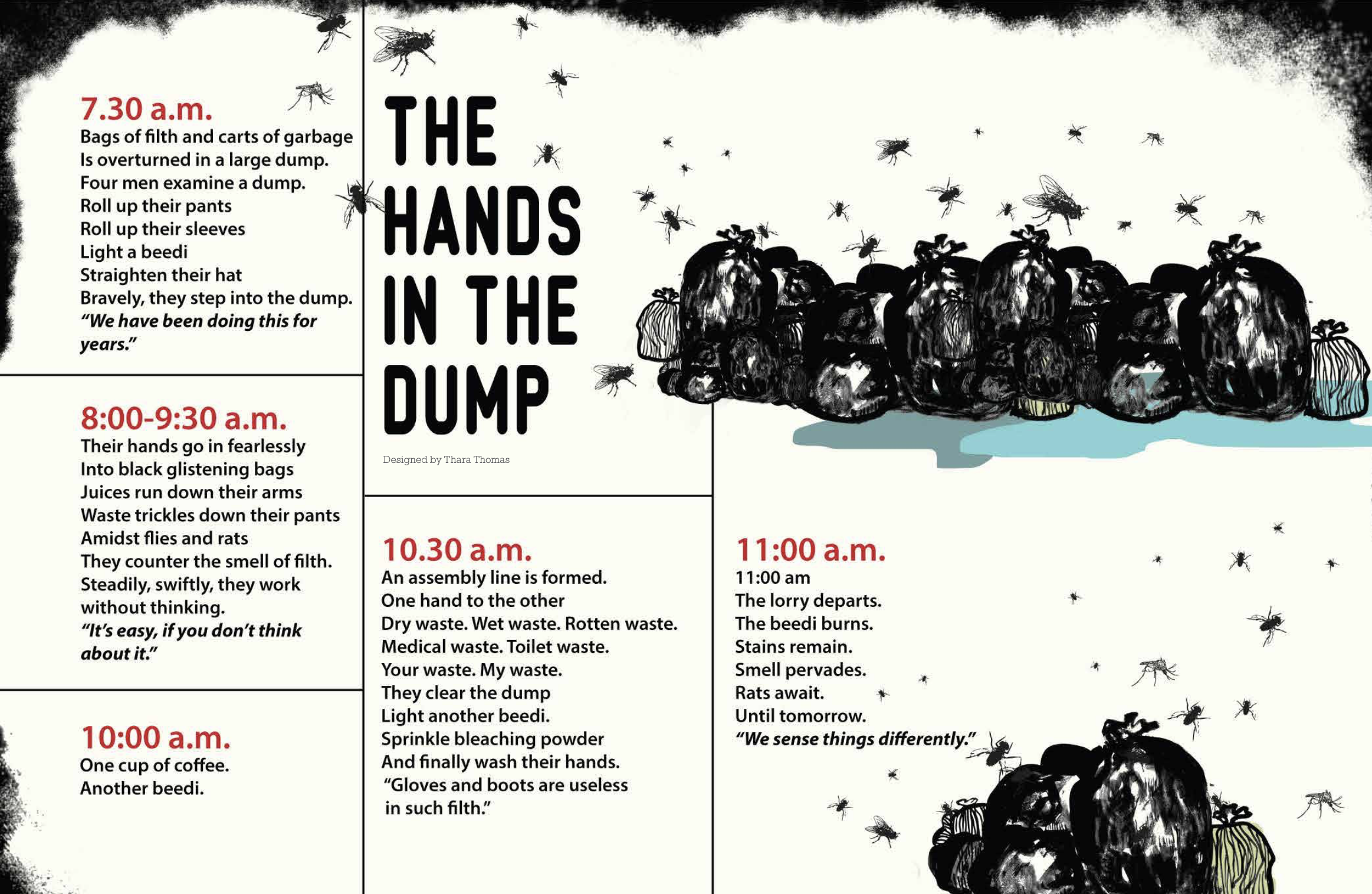
Maraa Collective, The Olfactory Chambers of Ward No. 88 (2014)

an agenda

Credit: Center for Sustainable Practice in the Arts

Maraa Collective (2008-)

This walk took place in Bangalore, India in October of 2014, and used the format of a tourism walk to critically examine the processing of waste and the caste system. The walking route followed the same route as the street sweepers and waste sorters. In India, the Dalits caste has been traditionally responsible for clearing excrement.

This work may remind some of Mierle Laderman Ukeles’ work in which she shook the hand of every sanitation worker in New York City, shining a light on their labor and demonstrating respect for their work.

CreditL

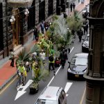
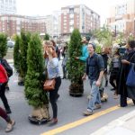
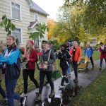
Lucia Monge, Plantón Móvil (2010-)

Lucia Monge (1983-)

“Lucia Monge started bringing people and plants together as Plantón Móvil in Lima, Peru. This is a participatory, walking forest performance that occurs annually and leads to the creation of public green areas.

“Plantón” is the word in Spanish for a sapling, a young tree that is ready to be planted into the ground. It is also the word for a sit-in. This project takes on both: the green to be planted and the peaceful protest. It is about giving plants and trees the opportunity to “walk” down the streets of a city that is also theirs. This walking forest performance culminates with the creation of a public green area.

Plantón Móvil started in 2010 while I was walking around Lima, my hometown, and noticing how many trees and plants had their leaves blackened with smog, were being treated as trash cans, or even used as bathrooms. I started to put myself in their place, and thought I would have left town a long time ago. Instead they are sort of forced to sit there and accept this abuse because of their planted “immobile” state. I wondered what it would be like to encounter a walking forest that had taken to the streets like any other group of people would do, demanding respect.

Plantón Móvil, however, is not a group of people carrying plants: at least for that time being we are the forest. I find it important to make this distinction because it changes the nature of the gesture. This is about lending our mobility to plants so that they can benefit from the speed and scale that draws people’s attention. In return; we may momentarily borrow some of their slowness. Essentially, it is about moving-with as a form of solidarity.” (credit)

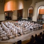
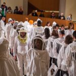
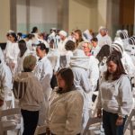
Diane Borsato, Your Temper, My Weather (2013)

“One hundred amateur and professional beekeepers performed periods of guided meditation and slow walking together in the Art Gallery of Ontario’s Walker Court. While exploring the tangible effect of collective stillness, the work created a platform upon which to
reflect on the health and temper of bees and their keepers, and on the policies and environmental conditions that affect our shared future. The work was performed for five hours for Nuit Blanche at the Art Gallery of Ontario.”

Credit: Morrell, Amish and Diane Borsato. Outdoor School: Contemporary Environmental Art. Douglas and McINtyre, 2021. Page 134.