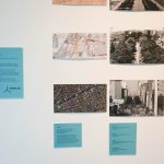
Graeme Miller, Linked (2003-)
“Commissioned by the Museum of London, Graeme Miller’s ongoing Linked project opened in July 2003 as a massive semi-permanent sound work and off-site exhibition of the contemporary collection of the Museum of London.
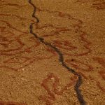
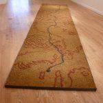
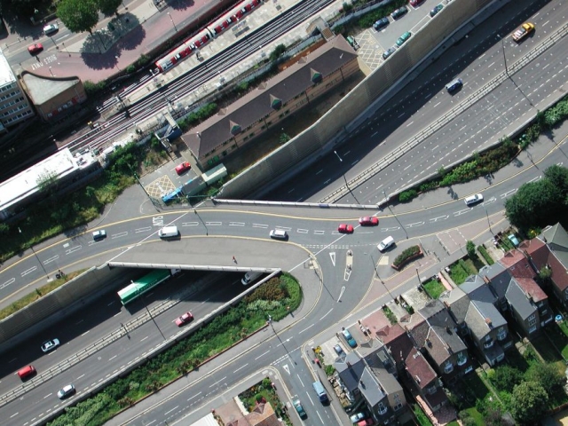
Stretching across from Hackney Marshes to Redbridge, the M11 Link Road was completed in 1999 after the demolition of 400 homes, including Miller’s own, amid dramatic and passionate protest. Concealed along the three-mile route, 20 new transmitters continually broadcast hidden voices, recorded testimonies and rekindled memories of those who once lived and worked where the motorway now runs evoking a cross-section of East London life. Day and night, voices and music were broadcast along the length of the route.
IN RECOVERY
Linked has endured as perhaps the largest sonic installation and sculptural entity in London for over 18 years. Since 2003 its transmitters have broadcast over a million times the voices of former residents of the 500 buildings demolished to build the M11 Link Road motorway.
Over these years some of the transmitters have been lost – to a lorry crashing into a lamppost, to accidentally being taken down by contractors, to weather, time and entropy. Amazingly many have endured and have become an almost secret layer of the landscape of East London. It is not only time to refurbish this work, but time to look at how it works in time and how public art endures or de-commissions itself. With this in mind Graeme Miller is currently looking to stage RE-Linked in 2022: the first annual 48-hour restoration of the entire network that will also include a reflective public conversation between former residents, interviewees and interviewers, sound and radio artists, eco-activists and, as ever, the wider curious walking public.
Please watch this space for developments and join us in 2022
“I found myself wishing that more of Britain was covered by such transmissions, ghosts of ravaged neighbourhoods set free to speak again.”
Libby Purves, The Times” (credit)