Category Archives: Mapping

Carol Maurer, Walking Forward, Looking Back (2018-19)

people on the floor in a gallery

Carol Maurer, Walking Forward, Looking Back (2018-19)

Walking forward, looking back is a practice-based project utilizing a journey through the landscape. Artist Carol Maurer walks from her ancestral home on the Eastern Shore of Maryland through Delaware to Chester County PA, collecting stories, photos, memories and objects along the route. Rediscovering histories – both true and false. ​The journey began as a way to experientially confront her responsibility as a descendant of enslavers and slowly weaves into a meditation on the time, tempos, conversations and understandings walking can make space for.” (credit)

Mollie Rice, “Field Study, Parramatta Road” (2018)

drawings of abstract lines on the wall and curled up on a pedestal

“Mollie Rice explores human spatiality, and sensations of place, through an experimental drawing practice. Multiple visits to a particular site by the artist yield sound recordings, which are then translated into drawings in the studio, creating a complex connection between percpetion and place, action and experience. The works in this exhibition were created through a series of ten thousand step walks along Parramatta Road, starting from a place of significance to the artist and ending in a new location, which is then explored through processes of active listening and the physical record of drawing. ” (credit)

Brett Stalbaum and others, Walking Tools (2009-10)

By Patrick Dow

Walking Tools is a project undertaken by Angela Black, Nichol Bernardo, Micha Cardenas, Cicero Silva, Steve Durie, Chris Head, Atom Leonhart, Todd Margolis, Jason Najarro, Chloe Sanossian, and lead by Brett Stalbaum, academics from the University of California San Deigo (UCSD) in which they used a loose confederation of software and related art and/or education projects across various languages, platforms and disciplines to share standards for content delivery and management of Global Positioning Satellite (GPS) data (by defining an XML schema extension to the standard GPX schema), allowing media and other data to be associated with GPS data.” Source: http://www.walkingtools.net/?page_id=2

Fostered under the umbrella of the walkingtools.net website and “brand” (owned and controlled by Brett Stalbaum and UCSD as an open source software project), the supporting software for the project is titled the Walkingtools Reference APIs. (III A iv 14) Brett Stalbaum was the primary software architect and programmer for this project, which began in 2007 in collaboration with Cicero Silva, currently of the Federal University of Juiz de Fora, Brazil. The HiperGps/HiperGeo project is actually three different related softwares.

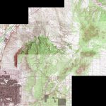
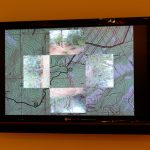
The first part is software that runs on inexpensive mobile phones that can direct a user on a tour of points of interest in a geographic area. It uses map and compass metaphors depending on GPS, and is capable of playing audio and displaying an image at the locations chosen by authors. This software was partially developed and first tested in a workshop with New Zealand students during the SCANZ 2009 Raranga Tangata Artist Residency (III A iii 28) in conjunction with the education program at at the Puke Ariki Museum Library in New Plymouth,on the West Coast of the North Island of New Zealand, from January 26th to February 8th 2009. The end result was a project titled the “Pukekura Park Demonstration/Environment and Sustainability GPS Tours.” (Section III A iv 1)

The second part of the software was developed for numerous workshops held in Brazil in 2009, including the 41st Winter Festival in Diamantina, Minas Gerais, hosted by the Federal University of Belo Horizonte (Section III A iv 2) and a Workshop titled “Locative Media: Theory and Practice” at the FILE Festival in Sao Paulo. (Section III A iv 3.) Another workshop was later held at UCSB. (Section III A iv 4). This software is a GUI for normal Mac/Windows/Linux desktops that facilitates producing content for mobile phones.

Essentially, it is a deployer for the mobile phone software (see above), allowing students to take latitude and longitude values, images, audio files and easily combine them into compiled bundles of mobile phone software that can then be loaded on a handset for use. The software allows non-technical creators to produce locative narrative tours for standard java mobile phones, and is especially targeted at beginning or casual users.

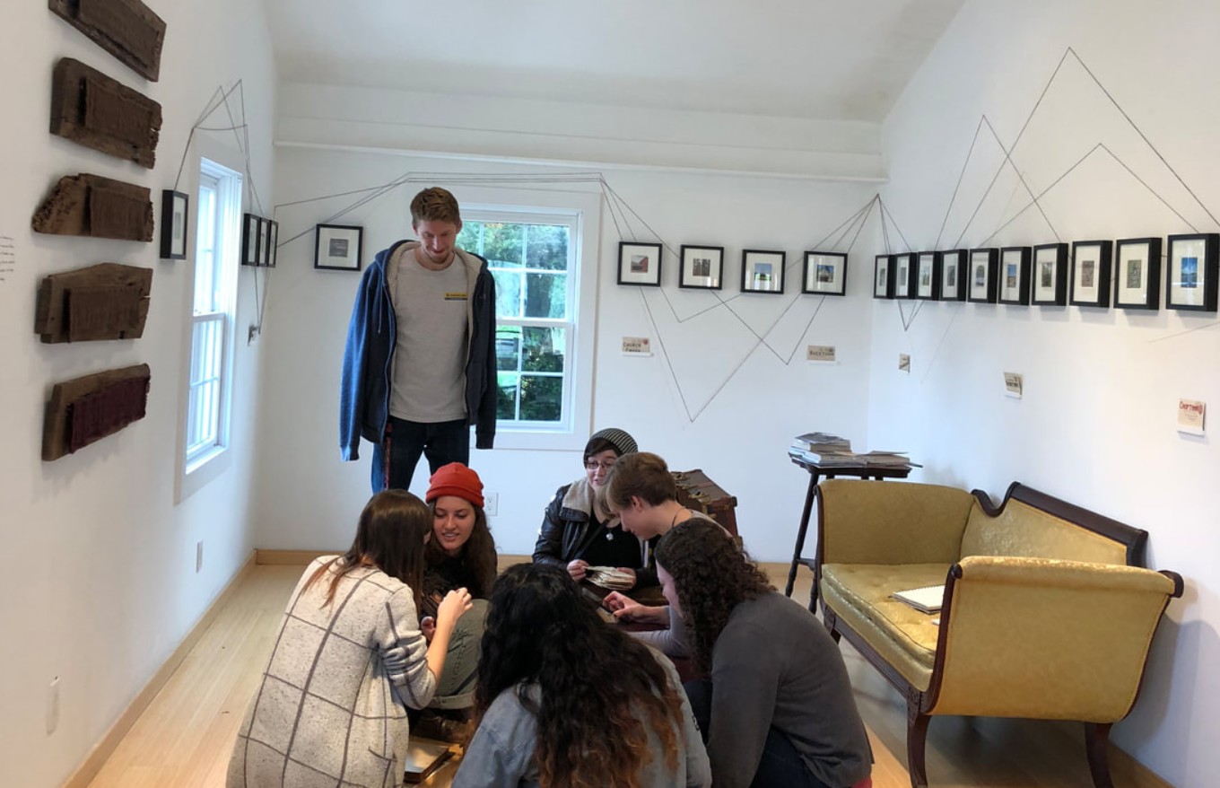
Brett Stalbaum has regularly assigned a project using this software in VIS40/ICAM 40 during the 2009/2010 academic year, where it helps facilitate a number of key skills. To produce a HiperGps project it is required that students learn to edit both images and audio files, and that the students conceptualise and plan an artistically interesting self-guiding audio tour of the UCSD campus, and ultimately deploy it to an actual mobile phone and demonstrates their work for critique.

Students have produced work ranging from the serious the to silly, from the simple to the sublime, and from the shortsighted to the significant. But they are introduced to emerging locative media art-making practice in a short three week assignment, all because HiperGps abstracts the normally highly technical computer programming tasks into simple actions taken in a familiar graphical user interface language designed to be easy to use. The project was in fact motivated by Brett Stalbaum and Cicero Silva’s desire to quickly introduce students to the practice of locative media in a practical way.

An important document that Brett Stalbaum authored is a manual that lays out HiperGps uses and techniques that is used in his classes. (III A i 5) Overall, this project represents the central piece of his educational research, and has proven to be a success in his teaching.

The third part of the software consists of a server-side web application that currently allows two activities. First, users of the HiperGps GUI could use it’s HiperGeo features to upload their tours to a web server. Second, features of the HiperGps application itself can contact that service and search for another’s content in the mobile phone user’s current location, download and “play” that content, creating a context for sharing.

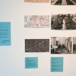
The first version of these server features was implemented during a few weeks in residence at the Edith Russ Site for Media Art, Oldenburg, Germany, in the summer of 2009. That software was part of the exhibition Landscape 2.0 that took place from August 29 through November 15, 2009 in Oldenburg, and where the public was first able to interact with and create/share their own mobile narratives. (See also nice Catalog at III A ii 5.) In addition, and based on a commitment to include undergraduates in research, HiperGps/HiperGeo’s role in theLandscape 2.0 exhibition was supported through a CALIT2 Summer Internship Program in which recent graduate Nichole Benardo helped with design and some web programming tasks. Another student involved in HiperGps/HiperGeo related work was Anubhav Chorpa, who worked on starting a parallel iPhone SDK version of the mobile software for two quarters of CSE 199 special studies.

Other professional accomplishments were related to the Transborder Immigrant Tool project, which is multi-researcher effort out of the B.A.N.G. Lab led by Ricardo Dominguez at CALIT2. Brett Stalbaum’s research contributions to that project have been directed toward software development and testing, culminating in 2010 with a working demonstration version of a public safety software platform including software for mobile phones and desktop computer. The mobile code is in part based on the Walkingtools Reference APIs (III A iv 14).

The idea was to provide the location of water stations in the along the Mexico-USA border by linking the information to mobile phones. The project is considered controversial by many within the conservative US establishment who accused members of encouraging and promoting illegal immigration. This caused some members of the project to be investigated by the UCSD and the UCSD Police Department. Source: http://www.walkingtools.net/Brett Stalbaum however maintains the project is an attempt to save lives, and prevent the unnecessary deaths of those attempting to enter the US illegally by crossing the deserts that line the US-Mexico border, who will still attempt to cross into the US regardless.

As part of our in situ research, I have built relationships with water station activists which has provided valuable feedback on the software design, and I now regularly volunteer filling water stations with Water Station Inc. The fully functional, working proof-of-concept source code for the mobile Transborder Immigrant Tool was officially released for public examination this summer, when presented by myself during a talk titled “Briefing on Transborder Immigrant Tool Source Code and Persecution of Professor Ricardo Dominguez” at Critical Code Studies @ USC (Critical Code Studies at the University of Southern California Conference) July 23, 2010. (II E 35). Other public presentations include: CIANTEC SÃO PAULO, Congresso Internacional Artes, Novas Tecnoloecnologias e Comunicação conference at Universidade MacKenzie, São Paulo, Brazil, Thursday September 18th 2008 (II E 31), and to the VOSMOB research group led by François Bar (Voces Móviles / Mobile Voices project,[1] ) at the University of Southern California, Thursday March 26th 2009 (II E 32), as well as in a group poetry reading at City Centered, a festival of locative media and urban community sponsored by KQED Public Media and Gray Area Foundation for the Arts at KQED studios, San Francisco June 11-13. Some of the highlights of the robust media coverage of the project were mine and Ricardo Dominguez’s appearance on KPBS radio’s “These Days” morning talk show program, hosted by Maureen Cavanaugh. on January 11th 2010 (III. B 27), and in an invited editorial “Academics make statement with project”, in the San Diego Union Tribune co-written by project leads Micha Cárdenas, Amy Sara Carroll, Ricardo Dominguez and myself, March 7, 2010.

The project has also received curatorial attention being included in prominent regional and statewide art exhibitions surveying the work of contemporary artists. The Transborder Immigrant Tool featured in both the “Here Not There: San Diego Art Now” at the Museum of Contemporary Art La Jolla, Jun 06, 2010–Sep 19, 2010, and the “2010 California Biennial” at the Orange County Museum of art Oct. 24 to March 13. I produced custom demo versions of the sofware designed to run on mobile phones mounted on the gallery walls.

I think the radio interview mentioned above could be useful for a more general understanding too.

Source: Brett Stalbaum’s electronic corresspondance August 2010.A video is available:

Link to AP Video on Transborder Immigrant Tool Project

http://www.youtube.com/v/L58Kjq4aHsM&color1=0xb1b1b1&color2=0xd0d0d0&hl=en_US&feature=player_embedded&fs=1“>

People most associated with the walkingtools HipeGps project are: Cicero Silva and myself, assisted by Nichol Bernardo.

TBtool: Ricardo Dominguez, myself, (Co-PIs) and Amy Carroll, Jason Najarro, Chloe Sanossian, Micha Cardenas, and Elle Mehrmand.

Link to New Media wiki home

Link to timeline of new media artworks” (credit)

Vanessa Berry, Parramatta Road: Landmarks and Monuments (2014)

“In the map of Parramatta Road created by Vanessa Berry, quintessential Parramatta Road features like car dealerships and teddy bear stores are elevated to the status of hallowed landmarks. Author of the book Mirror Sydney, and the blog of the same name, Berry explores and reflects the city with the eyes of someone who has traversed it, many times, and looked with intent at the fine details of its fabric and features.” (credit)

Bill Gilbert, Walk to Work (2009)

“For twenty-two years I have made the hour long drive from my house in Cerrillos to my office at the University of New Mexico. For this piece, I decided to walk to work. I strapped on a backpack, headed out my door and walked as straight a line as possible (given the variations in topography, land ownership, etc.) to my office at UNM. Along the roughly 50 mile trek across ranch land, the Sandia Mountains and the northeast quadrant of Albuquerque I recorded my perceptions from the perspective of a lone hiker walking across the land.

This work is part of a series of “Physiocartographies.” Started in 2003 in the field with the Land Arts of the American West mobile studio, the physiocartographies  series combines the abstraction of cartographic maps with the physical act of walking the surface of the planet to create portraits of place. In the various works from this series I follow prescribed paths across the landscape using a gps unit to navigate and record points, a camera to shoot images and a digital recorder to capture sounds. The final works appear as reconstructed maps, videos and installations.” (credit)

Lee Deigaard, Vixen. Vector (2013-17)


““Vixen. Vector” is a photographic series and installation that follows a former street dog essentially exploring Cartesian geometry on the streets of New Orleans (as she defies Cartesian dualism). She conducts a visual conversation with me using her body (and secondarily, the lines of the leash) to underline and express fleeting alignments and discoveries within urban (but also natural) spaces. I take photographs, shot from the hip as it were, cued by her pauses and interactions. How she moves, and how I move relative to her reveal angles of discovery and an essential and consciously rendered geometry. ” (from email exchange, June 2011)

“Lee Deigaard, Vixen. Vector
An arrangement of photographs chronicling sympathetic alignments and other canine geometries.

Former street dog defies Cartesian dualism, illuminates Cartesian geometry on the streets of New Orleans.

In my work, exploring levers of empathy (particularly between species), capturing the incidental signifiers (gesture, transient expression) relies on a convergence of reflex and impulse, situation and timing. On daily walks, tiger dog moves through the big city, carrying nothing, wearing nothing; her body is her vehicle and her expression. Photographs from our outings reveal fleeting and yet deliberate synchronicities and alignments– of limb and leash, shadow and sidewalk crack– created by a dog finding her place and translating her role within it. Through companionate mirroring of animate and inanimate forms, she delineates subtle harmonies. Her everyday geometry, its ephemerality and its searching sequences, are both improvisations and statements. To see the city through her is to discover a cursive- of routes and scent trails, of scribbled street runes. It’s an experience of deep reading.

Rescued from the streets, she retains aspects of a wild creature, like a coyote or a vixen, and the decisions she makes about where to go– the ways she exercises her autonomy, posits her theories of whereabouts and motives, and hunts the evidence– carry added poignancy.

Lee Deigaard lives and works in New Orleans, Louisiana and in rural Georgia. Her studio practice engages wild animals and collaborates with animals who are friends and family. Her work explores animal protagonists and the emotional spaces and physical landscapes where humans and animals co-habitate.” (credit)

Modelab, Ghost Walker (2014-15)

“Like photography negatives, urban design comprises information on what is not visible and only can be inferred by its contours. In this manner, urban geography becomes a catalogue of defeats and absences that can be interpreted from what once existed.

Based on Mexico City maps from 1867 and 1892, superposed on a 2014 Google map of the Juarez and Cuauhtémoc neighbourhoods, this project seeks to create an appropriation of histories through an artistic and scholar exploration of a specific street that ceased to exist more than a century ago.

Following the techniques of the Situationist’s dérive and Andrei Monastyrsky’s work with the Collective Actions Group, Ghost Walker: An Impossible Walk Through Mexico City’s History is a longitudinal study of a specific urban space, witness of a myriad of processes and modifications throughout 150 years

Ghost Walker (2014-15) has been presented at Muca Roma in Mexico City (2016), and as part of the group exhibition “Walk With Us” at the Rochester Arts Center (2022).

Participants: Sandra Calvo, Ramiro Chaves, Erick Meyenberg, Raul Ortega Ayala, Sergio Miranda Pacheco, Manuel Rocha Iturbide, Modelab.

DOWNLOAD PUBLICATION

Modelab is an artistic initiative aiming to promote interdisciplinary projects at the intersection of public space, history, and cartography.

Formed in 2014 by Claudia Arozqueta and Rodrigo Azaola, Modelab projects have taken place in streets, parks, billboards, beaches, museums, vacant retail stores, and other spaces in Australia, New Zealand, France, Mexico, Taiwan, and the Philippines.” (credit)

Omar Mismar, The Path of Love Series

“For a period of 30 days, I took a walk every day, navigating the city using Grindr, a geo-location gay mobile app that tells the users the vicinity of gay men around them. Each day I picked a man I desired, and tried to get as close as possible to him using the app. I kept a record of my routes and traced them into paths.” (credit)

Jeremy Wood, My Ghost (2000-2016)

“The qualities of our journeys are as subtle as the strokes of a pencil.
Our travels are textured as we squiggle on foot, dither at junctions, speed along motorways, and fly through air corridors.

For fifteen years I’ve record all my journeys with GPS to map where I have been and how I got there. It is a form of personal cartography that documents my life as visual journal.

Our journeys are shaped by the rules of the landscape. We route along engineered solutions as defined by paths and boundaries that tweak and tamper with our travels. At a time when it’s getting harder to experience the feeling of being lost perhaps we should try and stray away from recommended routes.” (credit)

“Jeremy Wood is an artist and mapmaker whose work is an expression of the poetry and politics of space. For over a decade he has been exploring GPS satellite technology as a tool for digital mark making on water, over land, and in the air.

Wood started GPS drawing to investigate the expressive qualities of digitally tracing his daily movements. His work binds the arts and sciences by using languages of drawing and technology to present a personal cartography. By revealing ones tracks the technology can introduce new approaches to travel, navigation and local awareness. GPS drawing engages a range of creative applications and challenges perceptions of scale by travelling as a geodetic pencil.

Wood specialises in public artworks and commissions with an original approach to the reading and writing of places. His work is exhibited internationally and is in the permanent collection of the London Transport Museum, the V&A, and the University of the Arts in London.” (credit)