Category Archives: Drawing

Larsen Husby, Long Trace of Minneapolis (2016-18)

//longtraceofminneapolis.com/

Turkeys crossing Stinson Blvd

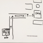
Larsen Husby “Turkeys crossing Stinson Blvd”

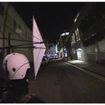
Watch video footage via MN Originals

“On October 3rd, 2016, I [Larsen Husby] decided to walk every street in Minneapolis. The parameters of this undertaking were as follows:

  • I must walk the entire length of every street within the city limits of Minneapolis, with the exception of streets which do not allow pedestrians, such as interstates and private streets.
  • Every walk must start with the intention of being a walk for the sake of the project; intention may not be applied retroactively.
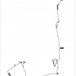
  • I must record the route, length, and duration of every walk; however, failure to record one aspect of a walk does not disqualify it from counting towards the ultimate goal.

Following these rules, I walked 1,315 miles, finishing on June 26th, 2018.

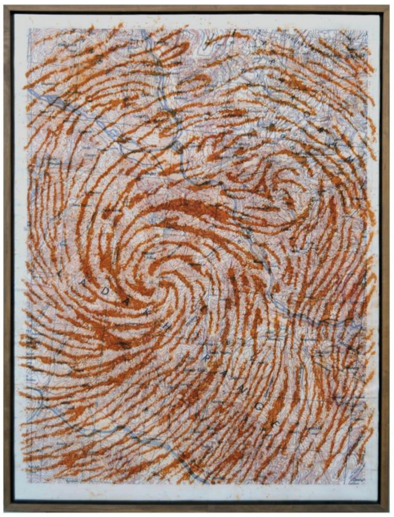
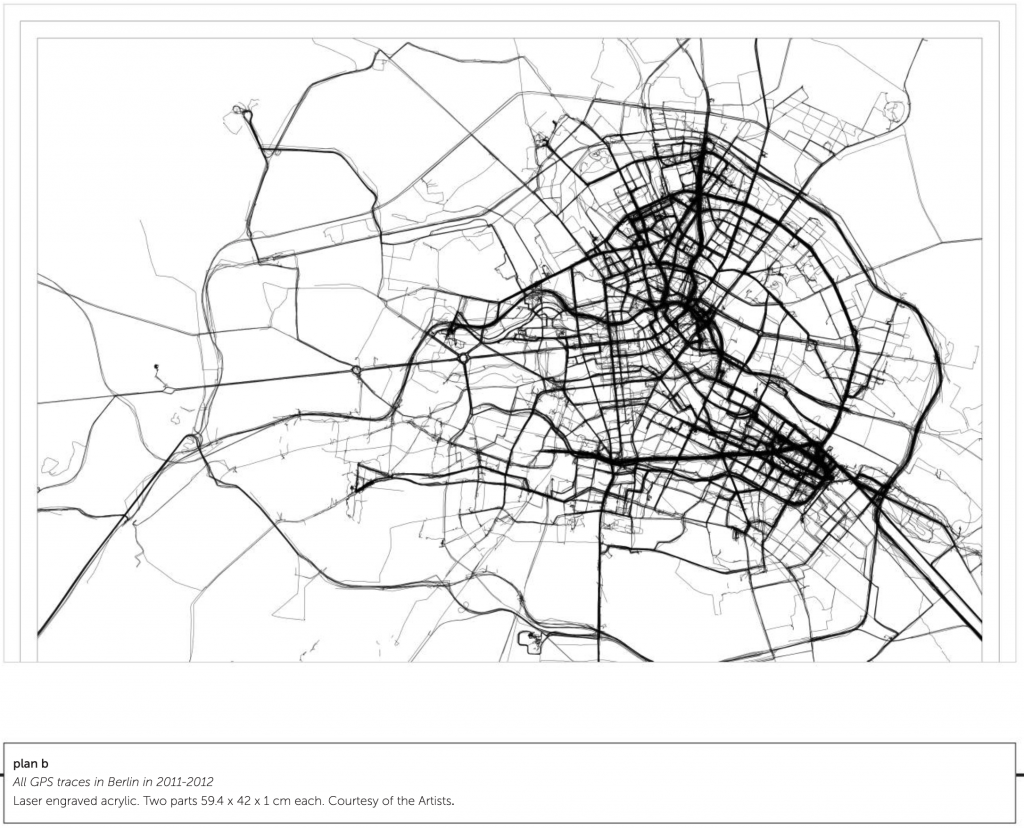
The title, Long Trace of Minneapolis, addresses two crucial aspects of the work. ‘Trace’ refers to the piece as an act of drawing: my feet are a pencil, drawing invisible lines across the city. If one could see them, these lines would add up to form a trace of the entire street network, a map of Minneapolis the size of Minneapolis. ‘Long’ describes the temporal nature of the piece, which is a lived experience, not an object.  Those invisible lines are drawn not only along the ground, but through minutes, hours, and days.

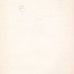
This website is a document of the piece. It contains records of the project in the form of maps, photographs, measurements, and written reflections.”

Mike Collier, Prints and Billboard


[credit]

“Part of Mike Collier’s practice involves curating walks for groups of people, often with the natural historian Keith Bowey; walks that are also collaborations – slow-moving, meandering explorations of urban ‘edgelands’, those marginal and often unsung places where rural and urban coincide. The shared information recorded when ‘botanizing on the streets’ with participants is layered intuitively into the fabric of his abstract paintings and drawings constructed back in the studio. Text is important in the architecture of Collier’s work; the familiar unfamiliarity of vernacular names, dialects of birds and plants once known but fleetingly remembered, hinting back to the specificity of places and their ecological frameworks.

Recently, Collier has embarked on a collab­oration with the Wordsworth Trust, working closely with the manuscripts of William and Dorothy Wordsworth (both inveterate walkers, whose walking is often vividly portrayed in these manuscripts). In the prints here (Daffodils 1 & 2 and Good Friday 1 & 2), he works simply, directly and intuitively over the image/text from the journals of Dorothy Wordsworth, responding not only to the words on the page, but to the place the words describe. He has walked these landscapes she describes many times over and understands them well.

MS JJ is a key ‘text’ in the history of Romanticism. The manuscript looks ahead to William Wordsworth’s “Two Part Prelude”, a poem with many references to Wordsworth’s extensive habit of walking and its importance in helping him to make sense of his life and art – indeed, it could be argued that this is where the West’s culture of walking began.”

Sarah Cullen “The City as Written by the City” 2005-2007

squiggly drawing

The City as Written by the City, Nov 2 2007, Walk to see Trudi and her new pin, Banff Centre – Banff Hospital

abstract drawing

The City as Written by the City, Out and about Florence with Muma, May 21, 2005

[credit]

“Sarah Cullen’s recent works have resulted from collaborative activities with geographers and other artists. In the past, she has created alternative methods of mapping space using low-tech machines and devices of her own invention.

Cullen has, for example, created a ‘drawing box’ consisting of a pencil pendulum that is able to record her movement in space in equivalent strokes of graphite on paper when carried around on a walk. The resulting drawings are almost anti-maps, in the sense that they cannot offer objectivity or legibility. Instead, her artworks bear indexical traces of her presence and motion.

What we lose in immediacy, we gain something in a sense of the weight and measure of movement – of the particular gait and pace of an individual’s walking style. Each of us moves through space with a highly particular and identifiable walk: it is a marker of the way we have learnt to occupy the world. Cullen asks us to re-imagine how we can document the ways in which we have ‘become ourselves’, in motion rather than at rest.”

Photos from constructing the boxes and doing workshops

Chris Drury, 2D works, 2003

a painting

“Ladakh III & IV” (2003), woven maps of Ladakh, pushed into a bowl and set within an area of watercolor paper, 60cm x 60cm


a painting

“High Desert Wind” (2003) a map of the Leh area of Ladakh, digitally printed over a diagram of the cross-section through the apex of the heart, made from rusted iron filings on wet paper (map, rust iron filings, paper) 104×138 cm

[credit]

“Chris Drury is perhaps best known for three­ dimensional works that include installations and sculpture made from natural materials, whether outdoors or in the gallery. Drury is a key figure in what has been called ‘land art’, though his work goes far beyond this term: it has involved collaborations with scientists and experts from a range of disciplines. Drury asserts that ordinarily his work is ‘political’ in that it is able to “draw attention to the way we abuse our environments”. However, another equally important preoccupation is his exploration of what inner or outer nature mean, and the inextricable connections between the two.

‘High Desert Winds’ shows an inkjet map of a walk in the Leh area of Ladak printed over a pattern from a cross section of the human heart made from rust iron filings. The patterns resemble the shape of winds from satellite weather maps. In his woven maps, Drury often weaves two very different or opposite places together uniting them into one. The earth pigments used in the works are always brought back from the actual place and used as dry pigment on wet ground. The most important aspect of walking for Drury is ‘the sense of place’ and the work is always what responds best to the place at that specific moment in time.”

Tim Knowles “From Windwalk – Seven Walks from Seven Dials” 2009

multimedia installation: helmet, sail, wall drawing and monitor

[credit]

“Tim Knowles creates photographs, films and abstract drawings by undertaking walks. Knowles’s working methods are deliberately improbable, idiosyncratic and inventive. He makes use of chance in innumerable ways, ensuring that the outcome of each walk is unknown in advance. As the critic Jessica Lack has written in The Guardian, 11 June 2009, his works are “generated by apparatus, mechanisms, systems and processes beyond the artist’s control”. They are “akin to scientific experimentation, where a situation is engineered in which the outcome is unpredictable. There is a poetry, English eccentricity and wit to the work”.

For ‘Walk On’ Tim Knowles presents an excerpt of a larger work, showing one of a series of seven walks made from Seven Dials, London. Each of these walks is guided solely by the wind as Knowles steadfastly follows a windvane mounted on a helmet worn on his head. He has no ability to affect the windvane and simply acts as a servant to the system he has devised. The wind takes him on a meandering route, at times blown directly down a street, at others caught in eddies repeatedly circling on street corners or joining the city’s other debris down some cul de sac. His meandering path collides with the rigid structure of the city; his route tracing out buildings, railings, ventilation shafts, parked vehicles and other boundaries. Knowles devises a new method of exploring the city and reveals how the wind moves through and is shaped by its structure.”

plan b “All GPS traces in Berlin in 2011-2012” 2012

a map

plan b

two people tracing

plan b

[credit]

plan b is the name that Sophia New and Daniel Belasco Rogers take when working collaboratively as artists. They are amongst the leading figures to engage with GPS technologies since their widespread availability over the last decade or more. Their practice is based on both walking and on data collection including, most notably, their GPS traces. Rogers has tracked every single one of his journeys for a whole decade. New has done the same since 2007. On several occasions they have exhibited an entire year’s worth of traces in one space, effectively making every action they take become public knowledge.

Such actions present ethical problems for us, as much as for the artists. The viewer becomes privy to the artist’s habits and, hence, inner life. If information about apparently innocuous activity such as walking through one’s own city can be timed, monitored and recorded by an artist, such information can easily be known by technology providers and sold to others. Those who might want to observe, redirect, restrict or control our behaviour have new ways of doing so. Most recently, plan b have engraved a whole year’s worth of GPS data onto a transparent acrylic sheet. The journeys that they routinely or repeatedly undertake are ‘dug’ out of the material in an almost archaeological manner. Their habits and ways of inhabiting the city are simultaneously made both monumental and as ghost-like traces.”

Brian Thompson, various sculptures 2012

[credit]

Brian Thompson has described his work as being “topographical in nature” – concerned with how places become known, understood, named and described. He is interested in the different ways in which we measure, describe and figure the land, and how his experience of walking through a landscape can be re-imagined through sculpture.

He uses a mixture of traditional craft skills allied to new technologies. His works ask us to imagine the formation of landscapes over a long timescale and explores the two- and three-dimensional forms and shapes associated with (amongst other things) walking through a site in order to map it and to unearth its history.

Thompson’s walks, recorded through GPS tracking or tracings from maps and aerial photographs, become the ‘line’ of the walks and the starting point of the sculptures and prints. These ‘lines’ are cut usually by hand and often in wood, with each layer becoming the template for the succeeding layer. Through small increments of size the sculptures evolve, tapering downward from top to base, incorporating errors and corrections; marking layer upon layer, in geological fashion, the history of their making. Sometimes these become ‘patterns’ for fabrication in materials and colors directly relevant to the location or simply have ‘come to mind’ when he makes the walks.

The work seen here combines forms alluding to archaeological and geological understandings of place, and to the imagined objectivity provided by Ordnance Survey mapping. Thompson notes of his three-dimensional works that “the sculptures serve as diaries, records, memories, souvenirs or trophies – celebrations of experiences of particular places”.”

Jeremy Wood “White Horse Hill” 2002

paper sculpture

Jeremy Wood

paper sculpture detail

Jeremy Wood

[credit]

“Jeremy Wood describes himself as “an artist and mapmaker”, and was one of the first artists to make use of GPS technologies creatively. These technologies have allowed him to trace his daily movements and to present a personal cartography. “Most GPS receivers record your whereabouts as a track, like a dot-to-dot or a digital breadcrumb trail. When the line is viewed on its own, you have a GPS drawing”, the artist says.

‘White Horse Hill’ is a scaled cardboard representation of forty-three kilometers of GPS tracks of methodical walks over the area round White Horse Hill in Uffington, Oxfordshire. The walking was informed by the making; a forty kilometre walk at 1:1 scale was translated into forty metres of card at 1:1000 scale. There were limitations; the walk had to achieve a certain density of tracks to capture the intricacy of the terrain, and no paths were to cross.

“We cannot know where we are on the ground without first looking up at the stars. The horse from the Bronze Age was made to be seen from the heavens and with Space Age navigation the heavens are used to see where we are. We don’t know why the figure of a horse was created, for a viewpoint unachievable then. And most of us don’t know how GPS works with orbiting satellites to tell us where we are now. The Uffington White Horse was chosen as a location for its wondrous communication between the ground and the sky; a relationship it has in common with the magical properties of satellite navigation technology.” (Jeremy Wood)”

Stanley Brouwn, “This Way Brouwn” (1960-64)

A compilation of maps drawn by passersby of directions to a particular location. The artist stamped them all with “This Way Brouwn”.

CURATOR, CHRISTOPHE CHERIX: What’s fascinating here is an artist making a work through his interaction with people. He’s basically delegating the making of his work, not to someone that he chose, but to anyone. And the artist basically gives you here only a starting point and stops right when the work begins.

What he did was to ask someone, “How can I get from here to another point of the city?” And he would hand them a sheet of paper, with a pen or a pencil. And, the passerby was asked to make the drawing. And what Stanley Brouwn did was to ask similar directions to different people. So on one side, you see someone who is telling him with very geometrical line how to cross the city, and someone has a much more smooth, fluid way of crossing the city.” (credit)

Gwen MacGregor, 3 Months New York/ Toronto (2004)

gps mapping

Video still. CREDIT: //www.gwenmacgregor.com/three_months_new_york_toronto.html

GPS Series – 3 months New York / Toronto

VIDEO

single-channel video, duration two minutes, 2004; exhibited: librairie-galerie Histoire de l’oeil, Marseilles, France; Rencontres Internationales Paris–Berlin, Circulo de Bellas Artes, Madrid, Spain; Theatre Babylon, Berlin, Germany, 2007; Transmedia Dundas Square, Year 01 Artist-run Centre, Toronto, 2006

THE FIRST OF THE GPS SERIES, this animation charts my movements for three months in New York and in Toronto. Each day is drawn and then partially fades to allow the day to be seen in the context of the accumulation. By leaving the page white, the identity of the locations are revealed over time. In this way the works uses walking as a creative drawing tool.

ABOUT THE GPS SERIES:
Since 2004 I have been carrying a GPS everywhere I go to record my movements. This raw data is used to create animated drawings for an ongoing series.

[CREDIT]