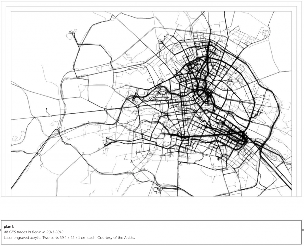
plan b
plan b
[credit]
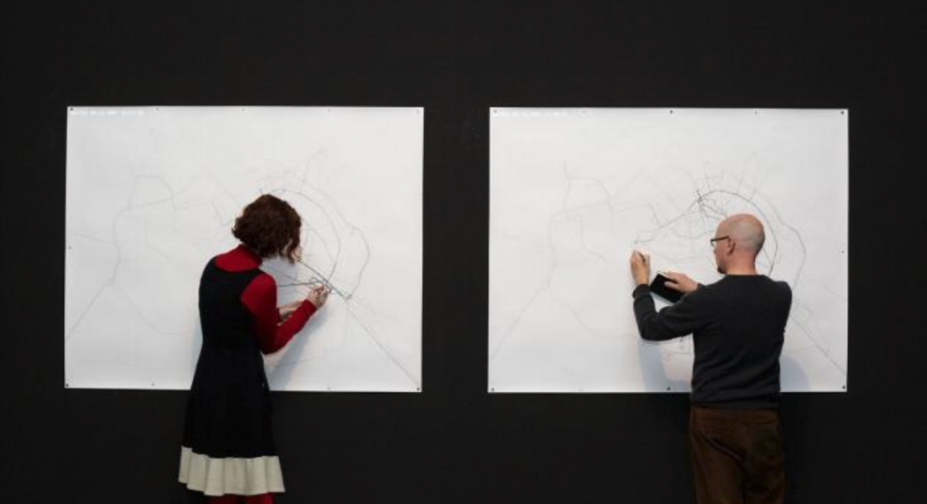
“plan b is the name that Sophia New and Daniel Belasco Rogers take when working collaboratively as artists. They are amongst the leading figures to engage with GPS technologies since their widespread availability over the last decade or more. Their practice is based on both walking and on data collection including, most notably, their GPS traces. Rogers has tracked every single one of his journeys for a whole decade. New has done the same since 2007. On several occasions they have exhibited an entire year’s worth of traces in one space, effectively making every action they take become public knowledge.
Such actions present ethical problems for us, as much as for the artists. The viewer becomes privy to the artist’s habits and, hence, inner life. If information about apparently innocuous activity such as walking through one’s own city can be timed, monitored and recorded by an artist, such information can easily be known by technology providers and sold to others. Those who might want to observe, redirect, restrict or control our behaviour have new ways of doing so. Most recently, plan b have engraved a whole year’s worth of GPS data onto a transparent acrylic sheet. The journeys that they routinely or repeatedly undertake are ‘dug’ out of the material in an almost archaeological manner. Their habits and ways of inhabiting the city are simultaneously made both monumental and as ghost-like traces.”