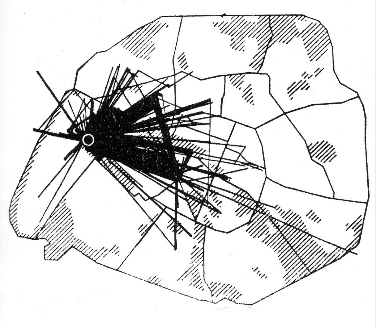
Situationists’ maps combined objective with subjective. This idiosyncratic map is based on the movements of a single individual studying at the school of political science. A triangle emerges — the vertices are the residence, the university and the home of a piano teacher.
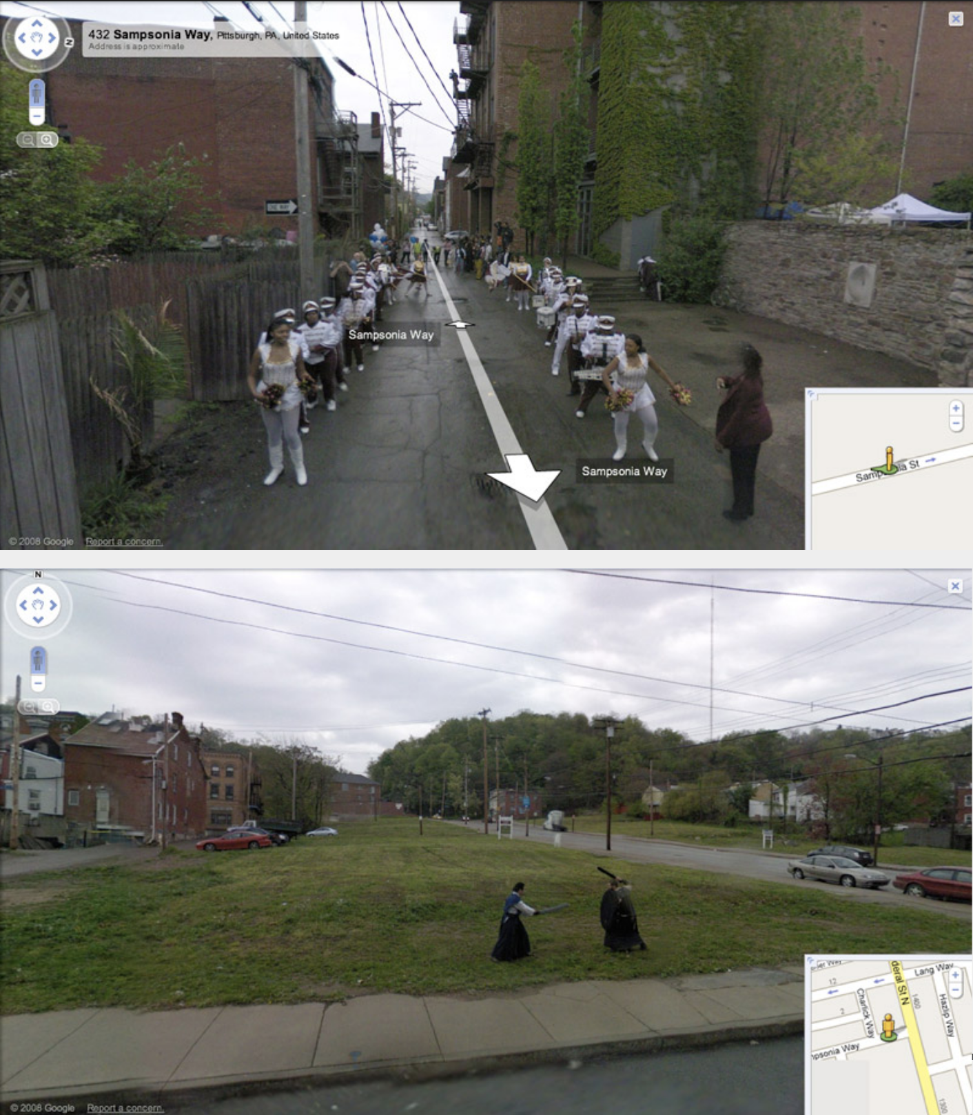
Hewlett and Kinsley invited the Google Inc. Street View team and residents of Pittsburgh’s Northside to collaborate on a series of tableaux along Sampsonia Way.
Technicians captured 360-degree photographs of the scenes in action and integrated the images into Street View.
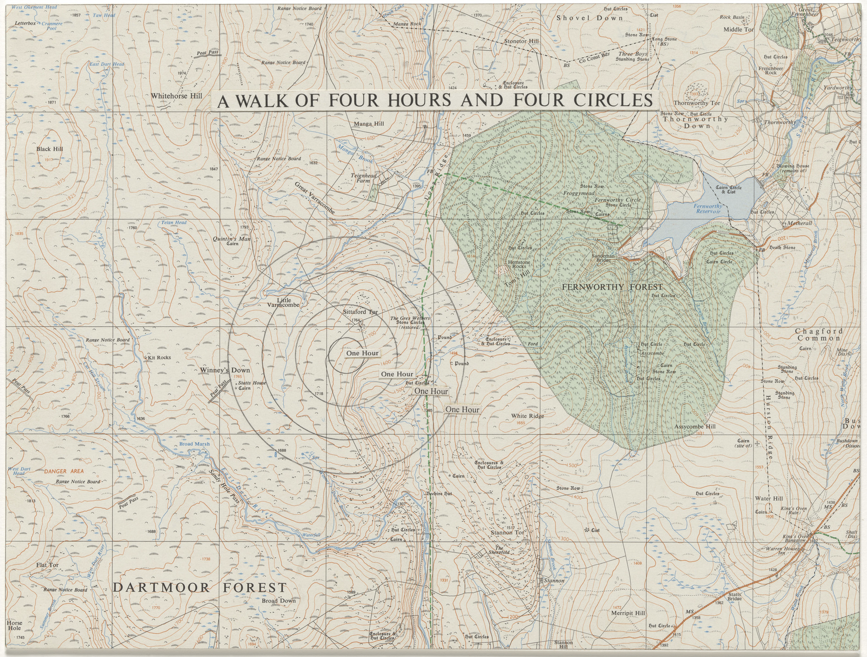
Medium: Presstype on cut-and-pasted paper on printed map with pencil
Dimensions: 9 1/2 × 12 5/8″ (24.1 × 32.1 cm)
Consists of a map with said concentric circles indicated, along with the title. Writer Rebecca Solnit observes, “On the maps the route of the walk is drawn in to suggest that the walking is drawing on a grand scale, that his walking is to the land itself as his pen is to the map, and he often walks straight lines, circles, squares, spirals.” – Wanderlust: A History of Walking. Penguin Books, 2000. Page 270.
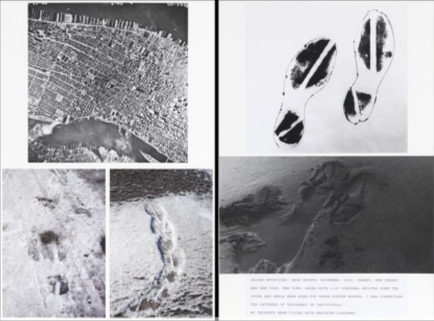
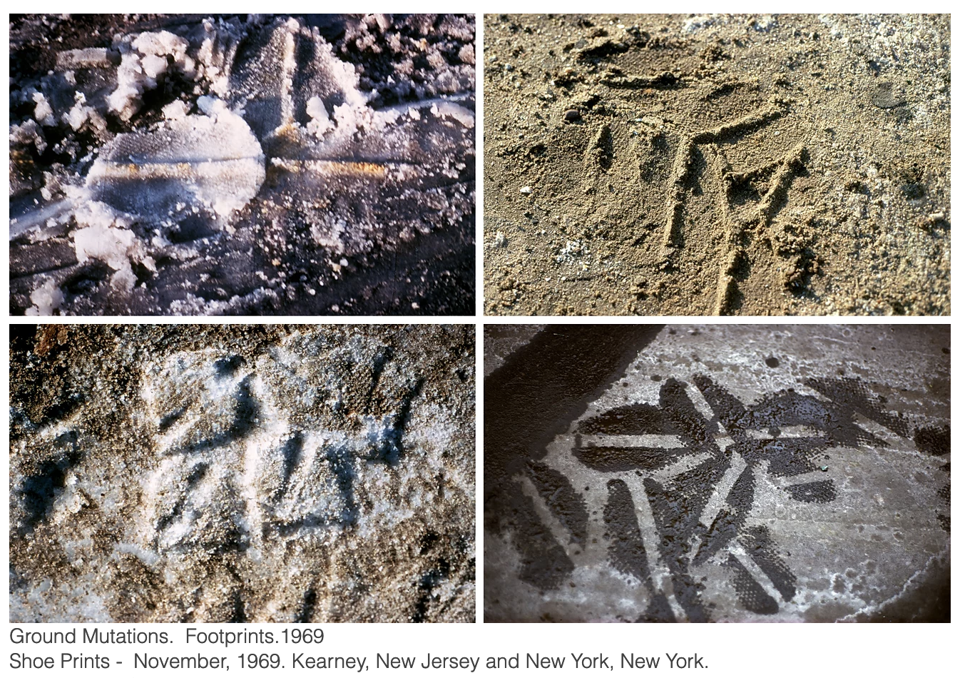
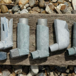
“Shoes with 1/4” diagonal grooves down the soles and heels were worn for three winter months. I was connecting the patterns of thousands of individuals… my thoughts were filled with marching diagrams.”
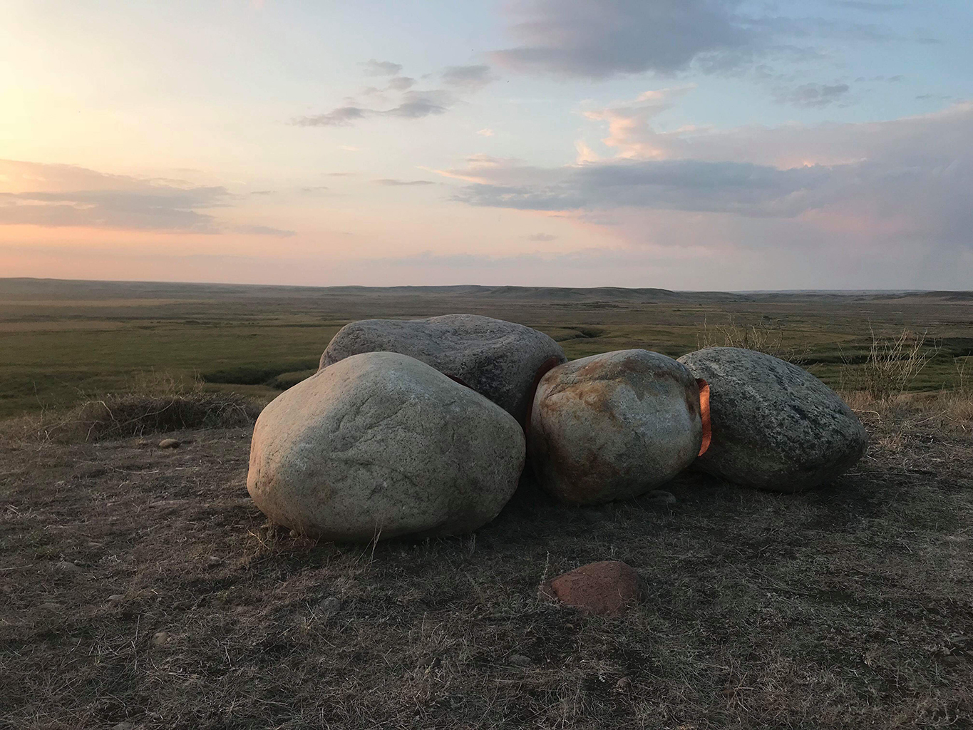
“Michael Belmore’s Coalescence was conceived as a single sculpture in four parts, [as part of LandMarks2017/ Repères2017 invites people to creatively explore and deepen their connection to the land through a series of contemporary art projects in and around Canada’s National Parks and Historic Sites from June 10-25, 2017.]. Sixteen stones, ranging in weight from 300 to 1,200 pounds, are fitted together and inlaid with copper, then situated to frame the vast distance between the southernmost boundary of the Laurentide Ice Sheet near Grasslands National Park in Saskatchewan, to one of its points of drainage into Hudson Bay in Churchill, Manitoba.
Sites in Riding Mountain National Park and The Forks National Historic Site, both in Manitoba, punctuate the stones’ migration. Together, the four locations mark meeting points between water and land: ancient shorelines, trade routes and meeting places, sites of annual mass migrations of animals, as well as the forced displacement of peoples.
Belmore uses copper as a way to invest the stones with labour and value. The stones come against each other to create a perfect fit, while their concave surfaces move apart slightly to reveal the warm glow of copper to reflect light. Each crevice is filled with a fire that will be extinguished with age, turning brown, then black, and reaching a luminous green hue as it settles into the landscape. They are a marker of how everything comes from the ground and returns to it, and how these processes stretch far beyond human understanding of time.
Belmore has created a moment of connection between deep geological time of stone and the linear human time of labour. On the occasion of the 150th anniversary of Confederation, this connection acts as a reminder of how the timelines of national celebration do not take into account the timelines of the land on which they take place. The stones were going to traverse a land familiar with rising and falling waters to reach their locations, but spring 2017 brought a record snowstorm and a spring melt that washed out the rail line that serves as the main transport artery between Churchill and southern Manitoba.
The political negotiations that followed have left the responsibility for its repair unresolved — part of the continued legacy of colonialism, the challenges of northern transportation and migration, and the importance of international trade routes that go back to Canada’s first trading posts. Belmore’s piece remains intact in Churchill, its splitting and migration halted by the processes that reach out from its conceptual core.” [credit]
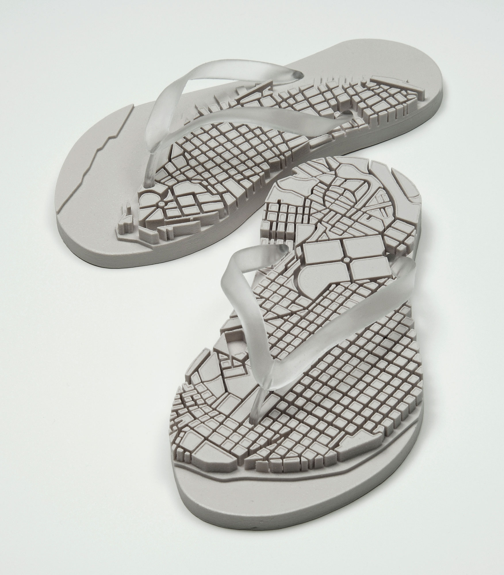
Two cast rubber sculptures
Each sandal: 12-3/4 x 5-3/4 x 2-1/2 inches
Edition: 60
“The sculpture multiple Sandalia is an edition of 60. The object is produced from a rapid prototype model and cast in rubber. By producing a limited edition of rubber sandals with relief maps of Havana neighborhoods on the soles, the artists adapted an ordinary object of mass production into a customized and poeticized icon that speaks of place, identity and culture. Sandalia derives from a series of watercolor drawings of sandals with maps. The right sandal depicts Old Havana, the left Vedado.”
“Over the past decade, Los Carpinteros (Marco Castillo and Dagoberto Rodriguez) have collaborated to develop their own poetic direction that functions in the imprecise boundary between art and craft traditions. Their carefully constructed works use humor to exploit a visual syntax that sets up contradictions among object, function and language.
Los Carpinteros have emerged as a vital force in the new, expanded terrain of global art. They live and work in Havana and Madrid and continue to travel and exhibit globally. For example: a major wall drawing was included in Drawing Now at the Museum of Modern Art-Queens, New York; their Transportable City was exhibited at the 7th Havana Biennial and at PS1 Contemporary Art Center in New York, the Los Angeles County Museum of Art, and the Contemporary Art Museum of Hawaii in Honolulu. In March, 2004 they exhibited a new body of work including drawings and large-scale wood sculptures at Anthony Grant, Inc. in New York City. In 2005 their exhibition Inventing the World premiered at the USF Contemporary Art Museum.”
A series of videos that attempt to objectively measure the furthest distance I can be from my son in a variety of environments; a city park, a back alley and Shursave supermarket.
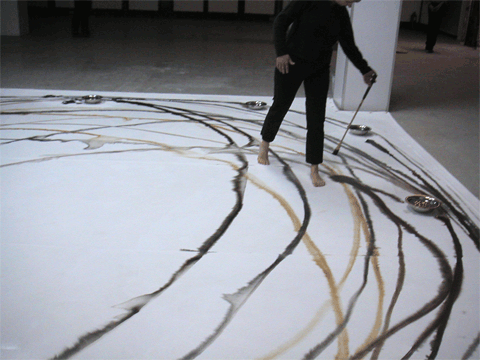
“Duration’s Wisdom II was made on the floor, by using a long handmade paintbrush. Twelve silver bowls were filled consecutively with black ink, brown pigment and water placed in a circle around the canvas. Dipping the brush into the bowls, placing it on the canvas and walking around the painting, she created a long circular, continuous line. Redipping the brush whenever needed, “I simply walked as long as I could around and around the canvas until I could walk no longer.” [credit]
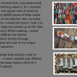
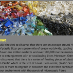
“I have always loved walking by the sea and was increasingly disturbed by the amount of plastic I was finding washed up on the beach. But in 2006, the United Nations Environment Programme reported that humankind’s exploitation of the oceans was ‘rapidly passing the point of no return’ and I was really shocked to discover that they estimated that on average there were around 46,000 pieces of plastic litter floating on every square mile of ocean, leading to the death of over one million seabirds and over 100,000 marine mammals every year due to entanglement with or swallowing of litter.
We now know that over 12 million tonnes of plastic end up in our oceans every year, travelling on ocean currents to every part of the globe. These plastics endure in the marine environment indefinitely: items from the birth of plastics are washing up on our shores, virtually unscathed. Scientists estimate that plastic can take 1000 years or more to degrade in seawater and even then will continue to pollute our environment with thousands of microscopic fibres: samples taken from a Northumbrian beach were found to have over 10,000 fibres in just one litre of sand… But disposal of plastics in our oceans isn’t just harming wildlife now. We are also providing a toxic legacy that may last an eternity. Moreover, plastics can be found throughout the food chain, even ending up in the food on our plates.
plastics, like diamonds, are forever…
The Challenge
I was so shocked by what I had learned, I felt I had to do something and resolved to ‘save’ one square mile of ocean by collecting 46000 pieces of litter whilst walking on the beaches near my home. Every time I visited the beach I picked up all the litter I could carry. My challenge took exactly a year to achieve (September 2006 – September 2007) and in total I walked over 200kms and carried away nearly a third of a tonne of rubbish.
But sadly my challenge will never really be complete. Scientists estimate that the amount of plastic in the sea is increasing at a rapid rate, doubling every 2 or 3 years. I’m still collecting (I can’t stop!). But this could be a lifetime’s work and I still might not save a single square mile of sea… My efforts may only be a literal splash in the ocean compared to the immensity of the problems are seas are facing. But what if everyone tried to do something about it? Luckily there is a lot more we can do – have a look here at the things we can all do…
Exhibitions The plastics I have collected have become my materials: I create huge installations with what I have found, ‘recycling’ it as art with potent message, playful but deadly serious. See photographs from some of my exhibitions.“
Reg Carremans (1981-) is a Brussels-based visual artist mapping the self and the environment through different media, to encourage critical introspection, (self-)awareness and reflective thought. Interested in humans as geographical beings (walking, landscape, environment, place, territory, cartography), and the artist and artistic processes (identity, basic actions, economy).
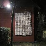
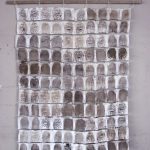
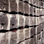
“Pathscape is a canvas walk for Sideways, a month-long itinerant initiative for contemporary art and culture. August – September 2012 | Belgium | Walks, canvas patchwork” [credit]
—
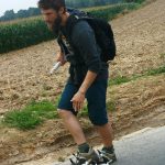
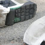
“Reg Carremans is a landscape painter who makes his work through walking or rubbing against the environment in which he is in. He was the only Belgian artist to complete the 375km Sideways 2012 Walking and Art Festival route, using canvas on the soles of specially adapted walking boots to gather multiple impressions for a series of ‘landscape paintings’ displayed en route.” [credit]