Category Archives: Archiving

Glowlab, One Block Radius (2004)

screenshot of a blog

Glowlab, One Block Radius (2004)

“Beginning in January 2004, artists Christina Ray and Dave Mandi-known as Glowlab – have been examining the block on which our new building will rise (Bowery to Chrystie Street and from Stanton Street to Rivington Street). Glowlab’s project, One Block Radius…provides an in-depth focus on this specific microcosm of New York City. This feature-rich urban record will include personal perspectives from diverse sources such as city workers, children, street performers and architectural historian. Engaging a variety of tools and media such as blogs, video documentation, field recordings and interviews, Glowlab will create a multi-layered portrait of the block as it has never been seen before.” [credit]

“One Block Radius, a project of Brooklyn artists Christina Ray and Dave Mandl [known collaboratively as Glowlab], is an extensive psychogeographic survey of the block where New York’s New Museum of Contemporary Art will build a new facility in late 2004. Engaging a variety of tools and media such as blogs, video documentation, maps, field recordings & interviews, Glowlab creates a multi-layered portrait of the block as it has never been seen before [and will never be seen again]. This website is an interactive archive for the project, which will continue to grow over time as we build a dense data-map of the block. The information collected is organized into three categories: observation, interaction & response. Click on each category to begin exploring the block.” [credit]

“While the block is bit-size in relation to the surrounding metropolis, the changes it is about to undergo are massive. One Block Radius plays with this idea of scale, aiming to zoom in and physically data-mine the tiny area for the amount of information one would normally find in a guide book for an entire city. This feature-rich urban record will include personal perspectives from diverse sources such as city workers, children, street performers, artists and architectural historians. ” [credit]


Amanda Heng, I Walk from the South to the North (2017)

This work saw Heng travelling alone on foot from Clifford Pier to the Causeway checkpoint in Woodlands. This solo walk continued Amanda’s interest in rituals, exchanges and their relationship with live performance in daily life.

“Heng has been a central figure in Singaporean performance art as well as feminist discourse in Singapore since the 1980s.

In 2017, Heng performed “I Walk From The South To The North” which constitutes a series of daily walks spanning the duration of two months (September – November). … From my perspective, this work is a comment on the breakneck speed at which Singapore develops. Bridges, skyscrapers and entire parks are built in the span of a few months. The urban landscape morphs and mutates unforgivingly. How do people hold on to memory and history?

It also reads to me as a reflection on technology and how we wield it in our contemporary lives to ‘make lives easier’. Singapore is a technologically advanced country with a highly comprehensive transport system. What is the point of walking anywhere anymore? Smartphones are ubiquitous, Google Maps is the most sensible mode of navigation. What is the point of talking to anyone, asking for directions anymore? Heng’s work brings focus back to the physical and social nature of the body and sheds light on the effects which technology has on that.

Could you tell us a bit more about your most recent walk from Clifford Pier to the Causeway which you took from September to November 2017?

It is titled “I Walk from the South to the North”. The participation is a little different from my previous walks. I deliberately do not get myself acquainted with the route so I start to ask around for directions so where I go depends entirely on who I chance upon and how forthcoming they are. I’d get these people to draw out maps or write out directions and these form part of the documentation for this project. Many people I approached were generous with their help and were surprised I wanted to walk so far. They kept insisting it was much faster to take the MRT nearby.” [credit]


Jennifer West, One Mile Parkour Film (2012)

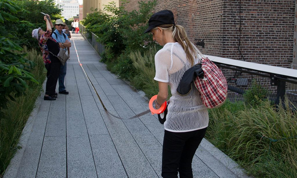
woman laying film on the ground

Jennifer West, One Mile Parkour Film (September 13, 2012; 7am-11pm)

[credit]

“Location: Entire length of the High Line, from Gansevoort to West 30th Streets

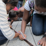
Jennifer West is known for using unusual materials to alter her films, drawings, and collages. She has used coal-tar dye, eyeliner, whiskey, hot sauce, deodorant, and even skateboard wheels. For the High Line, West has staged a public performance by taping a one-mile-long 35mm filmstrip to the High Line pathway for one day during park hours. The thousands of visitors to the High Line that day are invited to leave their mark on the filmstrip with their shoes, heels, and hand prints to etch the film with the walkway’s many surfaces. Visitors are encouraged to wear stilettos, tennis shoes, combat boots, bare feet, or other shoes that to significantly alter the film. After the performance, the filmstrip will be treated with related materials and actions, a signature of West’s work.

The 59-minute filmstrip features images shot by West and her crew in June 2012 of New York locations typically not accessible to the general public. The film also features performances by two New York-based Parkour artists, Thomas Dolan and Vertical Jimenez. Best known for their ability to spontaneous run through urban environments and rooftops, their flips, jumps, rolls, and handstands were double-exposed over images shot around the High Line.

After the performance, the marked-up film will then be transferred to high definition digital format and shown on the High Line in October.

Splash Dance
9:00 – 10:00 AM
Diller – von Furstenberg Sundeck & Water Feature, on the High Line between West 14th and West 15th Streets
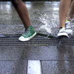
Elementary school students from Public School 3 in the West Village perform a playful dance to tunes by legendary pop star Michael Jackson. The same dance will be performed twice over the course of the hour.

Art Station
2:00 – 4:00 PM
14th Street Passage , on the High Line at West 14th Street
Stop by the semi-enclosed passageway on the High Line at West 14th Street to manipulate the celluloid film strip with various materials and tools.

Parkour Performance
9:00 –10:00 PM
On the High Line under The Standard, New York
Parkour dancers, called traceurs, will perform on the celluloid film strip, which contains images of the same traceurs performing in other locations at the High Line. Parkour is type of physical activity focused on effortlessly maneuvering around obstacles with speed and efficiency.

(1,2) Photo by Michael Seto; (3,5) Photo by Maggie Romano; (4,7) Photo by Scott Lynch; (6,8) Photo courtesy Friends of the High Line; (9) Photo by Liz Ligon; (10) Photo by Select Nights. 

Artist bio

Jennifer West (b. California) lives and works in Los Angeles. Recent solo exhibitions include Marc Foxx, Los Angeles (2013); S1 Artspace, Sheffield, England (2012); Vilma Gold, London (2011); Contemporary Art Museum, Houston (2010); Western Bridge, Seattle (2010); Kunstverein Nuremberg, Nuremberg (2010); Transmission Gallery, Glasgow (2008), and White Columns, New York (2007). She was an Artist in Residence at the MIT List Visual Arts Center and has been commissioned for special projects at the Tate Modern, London and the Aspen Art Museum, Colorado. Her work has been included in group exhibitions at the Saatchi Collection Gallery, London (2012); Henry Moore Foundation, Leeds (2012); Remap, Athens (2011); White Columns, New York (2011); Schirn Kunsthalle Frankfurt, Germany (2010); and the Seattle Art Museum, Seattle (2010), among many others. West was shortlisted for the 2012 3rd Annual Nam June Paik Center Award in Korea.”

Angela Ellsworth and Steven J. Yazzie, Museum of Walking (2014-)

[credit]

The Museum of Walking (MoW) is an artist led educational resource center committed to the advancement of walking as an art practice. MoW is an educational resource committed to people, land, action, and site through the everyday act of walking. Walking is a defining human activity with poetic and political resonance as well as mundane and ceremonial manifestations that play a central role in contemporary art, social and cultural history, health, and sustainable lifestyles. Whether alone or with a group, moving through space creates connections between people and the environment, as it promotes well-being and enhances creative divergent thinking.

MoW houses a small-but-mighty archive and library comprised of walking related material engaging disciplines of art, science, philosophy, health, activism, contemplation and cartography. Through workshops, exhibitions, experiences, and site-specific projects MoW fosters relationships between people, land, action, and place.

The Museum of Walking was founded in 2014 in 120 square foot space. As an itinerant museum we now reside in numerous places. “

Lisa Myers, and from then on we lived on blueberries for about a week (2013)


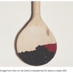
Lisa Myers, ‘and from then on we lived on blueberries for about a week’, made for MAP Spring 2013, 6’44” (animation with assistance from animator Rafaela Kino). This work pays homage to an on-foot journey her grandfather undertook to flee Shingwauk Residential School in Ontario. Myers herself once did an 11-day walk tracing the route of her grandfather’s journey.

“When he was a boy, artist Lisa Myers’s Anishinaabe grandfather walked some 250 kilometres along Northern Ontario railroad tracks for one reason: to escape Shingwauk Residential School in Sault Ste. Marie.

Myers recorded her grandfather’s account of this journey during a conversation with him in the 1990s—and she listened it to it many times before she made the decision, in 2009, to walk the route he’d described alongside her cousin Shelley Essaunce and her nephew Gabriel.

Myers and the Essaunces took 11 days to walk the 250-kilometre journey.

“After this walk,” Myers writes in a 2016 Walter Phillips Gallery exhibition essay titled “Rails and Ties,” “I began thinking about how to locate myself within my grandfather’s story, and about how I wanted to convey its different iterations. One thing that struck me was that he survived by eating blueberries growing along the tracks. He said, ‘and from then on we lived on blueberries for about a week.’”

The latter quotation from her grandfather became the title for a video installation by Myers—one related to trauma, food, walking and survival—that was on view at Artcite in Windsor this spring as part of the exhibition “Walks of Survivance.”

“Instead of always repeating his story, [walking] was a way of finding myself in that story,” Myers told curator Maya Wilson-Sanchez a few years ago. And by walking, Myers also told Wilson-Sanchez, she was “able to bring the places in the story to life.”

“When I recall walking across the railway bridge over the Mississauga River north of Lake Huron,” Myers writes in “Rails and Ties,” “I think about my fear of the elevation, and how gusts of wind unsteadied my steps. Finding my footing meant looking down and seeing the river rushing 50 feet below the railway ties of that century-old steel bridge. The Mississagi River flows into Lake Huron, the railway crosses the river, and from my grandfather’s account of his journey this was the first place (after leaving school) where he heard his language and saw Anishinaabe people cooking and sharing food down by the river. They welcomed him, and fed him.”

During her walk in her grandfather’s footsteps, Myers also heard stories of other youth who had escaped the way he had. Ultimately, her works on this theme—which include both abstract and map-like prints made with blueberry pigments, as well as documentation of wooden spoons stained with blueberries she has shared with others, also speak to a complex intertwining of group and individual journeys, of landscapes that are real and imagined.

“The spoons represent sharing, sustenance and the gathering of people,” Myers writes. “When I line these spoons up side by side, the reddish-blue marks continue from one utensil to the next, recalling an imaginary topography or horizon line created by the trace of berry consumption.”

In this sense, walking and artmaking become different ways of tracing and “straining” an experience.

“Straining to survive, or even to be accepted, means the less digestible parts of stories need to be retained, traced, remembered and told,” Myers writes.

Of course, Myers is not alone in thinking about walking as a mode of Indigenous resistance and survival.

“There’s the water walk that is happening, and which is not directly art-related,” Myers said in a phone interview. “But I think Indigenous artists are wanting to also acknowledge that these forms of activism are happening. There was walking from a community in Nunavut, [Idle No More] walking to Ottawa to make a point.”

“Walking to safety is a really important narrative in talking about survival, and surpassing survival to freedom,” says “Walks of Survivance” curator Srimoyee Mitra.” [credit]


Lisa Myers, ‘Blueberry Spoons’, 2010, video, 7’37”

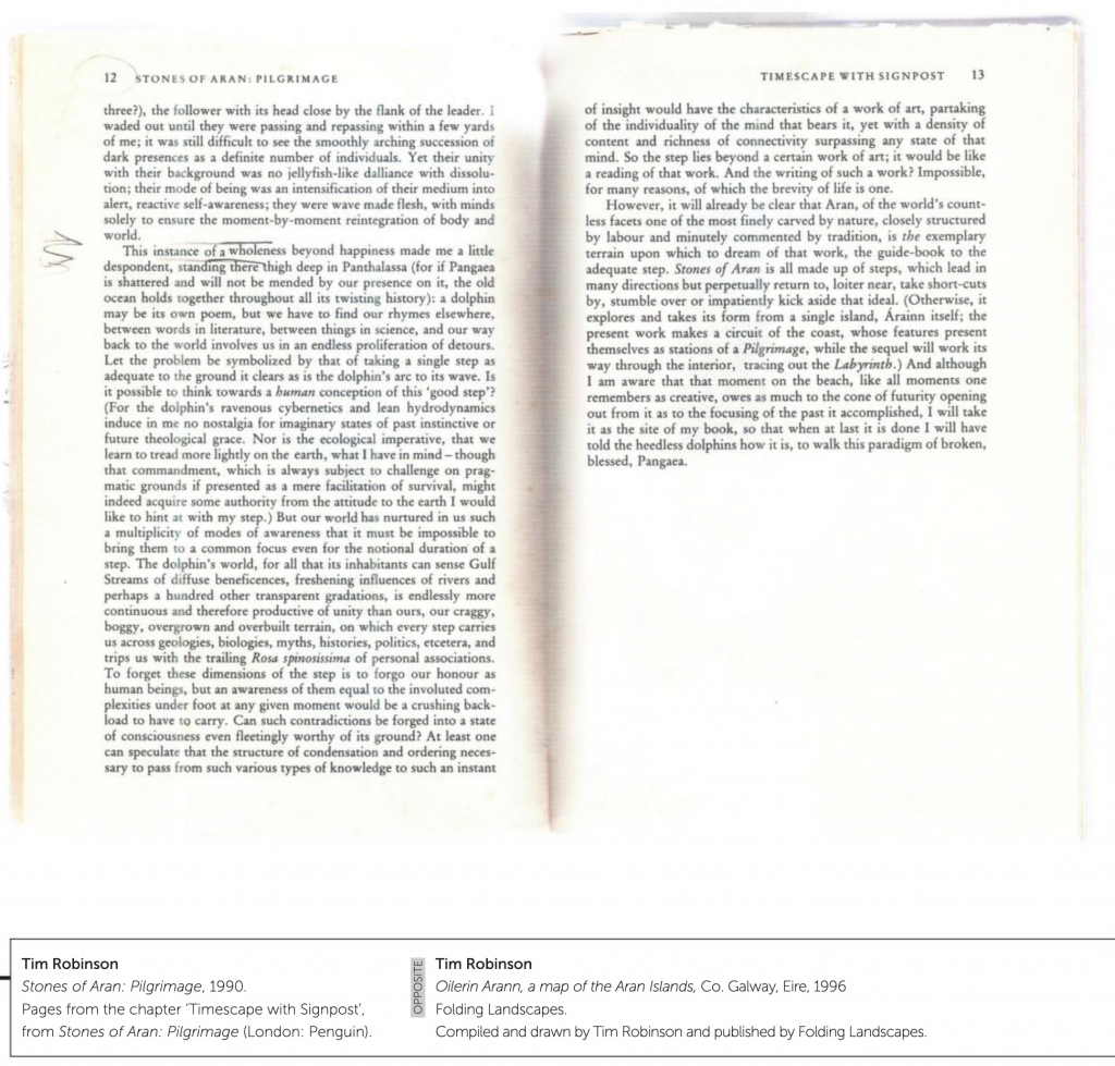
Máiréad and Tim Robinson, Folding Landscapes (1972-)

a map

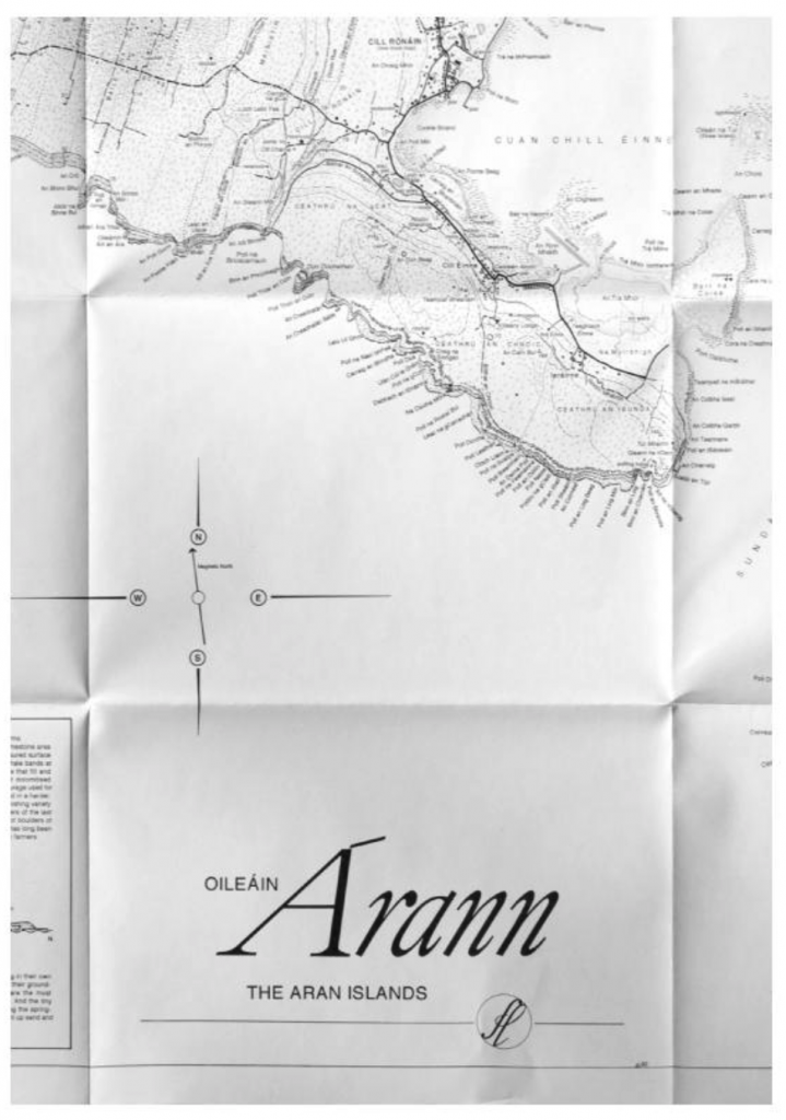
Tim Robinson “Oilerin Arann a map of the aran islands Co. Galway eire” (1996)

“Tim Robinson [1935-2020] is the alter ego of artist Timothy Drever whose abstract paintings and environmental installations were seen in a number of exhibitions in London before he moved to the west of Ireland in 1972. Robinson originally studied mathematics at Cambridge and worked as a teacher and artist in Istanbul, Vienna and London.

He and his wife, Máiréad [1934-2020], [then lived] in Roundstone in Connemara, where, in 1984, they established Folding Landscapes, a specialist publishing house and information resource center dealing with three areas of particular interest around Galway Bay: the Aran Islands, the Burren and Connemara. The maps and accompanying books are beautifully drawn and meticulously researched, explaining, often for the first time, the derivation and meaning of hundreds of place names and representing a wide range of information about the region’s culture and landscapes.

[They] gained much of this information literally on the ground, walking with naturalists, historians, archaeologists and other specialist through the landscape. [Their] maps and books provide an invaluable guide for visitors to the region as well as nourishing community spirit by identifying the irreplaceable uniqueness of the local environment and history. Tim and Mairead also run Unfolding Ideas, an annual Colloquium Series for scholars, educators and artists to engage in public talks, small group discussion and workshops in Roundstone, Connemara.”

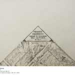
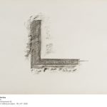
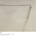
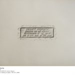
Francisca Benítez, “Property Lines, New York” (2008)

[credit]

76 floor rubbings
made on the sidewalks of New York
18″ x 24″, graphite on paper, 2008
Edition of 3

There are seventy rubbings in the series and they were installed as a grid on the wall, with varying dimensions depending on the location. The simple act of tracing in this set of walking-based drawings asks questions about borders, public versus private space, and how people mark space.

Francisca Benitez (b. 1974, Chile) lives and works in New York. Recent solo exhibitions include Cuchifritos Gallery + Project Space, New York (2014); Museo de Artes Visuales, Santiago, Chile (2013); Die Ecke, Santiago, Chile (2011); and Nada.Lokal, Vienna, Austria (2009). Notable group exhibitions include Mapping Brooklyn, Brooklyn Historical Society and BRIC House, Brooklyn (2015); Efemérides, Museo Histórico Nacional, Santiago, Chile (2014); Pier 54, High Line Art, New York (2014); One Minute Film Festival 2003 – 2012, MASS MoCA, North Adams, Massachusetts (2013); The Street Files, El Museo del Barrio, New York (2011); and Contaminaciones Contemporáneas, Museu de Arte Contemporánea da USP, Sao Paulo, Brazil (2010). Her work has been featured in major international exhibitions including the Bienal de la Habana, Cuba (2015); Lisbon Architecture Triennale, Portugal (2013) the Beijing Biennale, China (2009); and the LA Frewaves 10th biennial of film, video and new media, Los Angeles (2006).” (credit)

Eduardo Navarro, Poema Volcánico (2014)

person in protective suit visiting a volcano

Eduardo Navarro – Poema Volcánico – 2014

Poema Volcanico deals with the Ecuadorian volcanic geography. In 2014, while climbing the active volcano Guagua Pichincha, Eduardo Navarro created drawings from litmus paper, which measured the acidity of the gas emissions produced by the fumaroles inside the crater of the volcano. [credit]

“Eduardo Navarro lived in Ecuador between the ages of eight and twelve. During that time, Navarro would eat breakfast and dinner daily in front of a volcano, pondering it. The artist noted that as an adult, it meant a lot to him to return to the country to create a work of art that was both sentimental and a personal artistic challenge.

Leading up to the 12th Bienal de Cuenca, Navarro got the idea for his volcano-related artistic endeavor. He thought, “How can I work with the geography, landscape, and energy of the volcano? Instead of documenting a volcano (since we live in a world overly saturated with on-demand digital imagery), he wanted to create a project that would allow the volcano to express itself, and to do this, decided that he would have to enter it.

Navarro then got in contact with renowned Ecuadorian volcanologist Silvana Hidalgo of the Instituto Geofísico in Quito to confirm for certain which volcano it would be possible for him to enter without assuming the actual risk that it would erupt while he was inside. Through his extensive research and conversations with Silvana, Navarro decided to work with the Guagua Pichincha volcano.

Guagua Pichincha was known as one of the safer active volcanoes to trek into in Ecuador. To provide a comparison, Cotopaxi was another option, but Navarro explained that one had to be on the level of a professional mountain climber to enter its crater. Guagua Pichincha, on the other hand, was known in Ecuador as the “training mountain” that one would tackle before becoming a professional climber.” [credit]
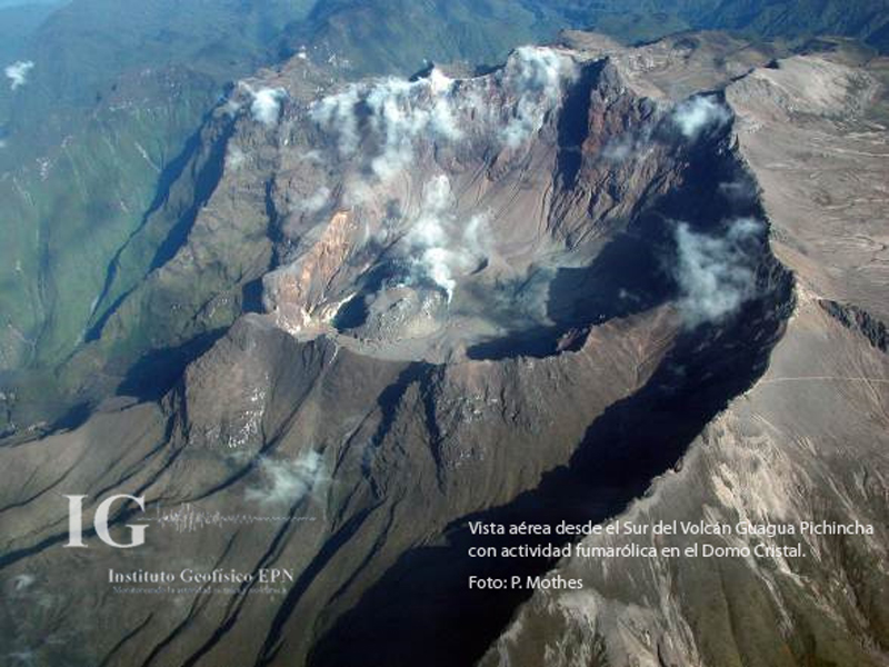
Guagua Pichincha volcano

Guagua Pichincha volcano

“Once Navarro decided upon the Guagua Pichincha, he had to figure out what his process would be leading up to the climb and artistic execution. After spending the required monthlong period adjusting to the proper oxygen level for the climb, Navarro decided to enter the crater twice, with two different guides (including record-setting climber Karl Egloff). His first trip would be to see what the crater was like, test expectations, and become familiar with the experience of going inside it. His second trip would be geared toward executing the artistic portion of the project.

On the first trip, Navarro realized first-hand how difficult it was to trek down into the crater and come back up, regardless of the intense physical prep work he made sure to do in advance. Also on the first trip, Navarro identified fumaroles (the cracks where smoke escapes from the volcano’s center) as the feature of the volcano he wanted to pursue working with artistically.

In regard to how he was going to work with fumaroles, one of Navarro’s first ideas was to get a woven basket, lower it down into the crater, and then try to pull it back up and see what would come out. Navarro thought that this could be an interesting idea, not only because baskets are accessible and would allow gases and sulfur to move freely through them, but because choosing woven baskets would give him the opportunity to work with an object that was native to Ecuador.

Navarro then had only a ten-day period between his two descents to figure out the details of both the device he was going to provide the volcano with so that it could express something, and the protective suit he was going to wear during the trek (most volcanologists wear fire protection and oxygen masks when entering craters). He went to the local fire department and asked if he could borrow a fireproof suit, and while the personnel there couldn’t provide him with one, they directed him to where he could get the materials so that he could make one of his own.

There is no question that Navarro’s descent into the crater was a high-risk undertaking. Navarro noted:

It is a sad thing when you pass the guards in the front (entrance) at Guagua Pichincha. A few weeks prior, three geologists went in. One almost died and two had to be rescued with a helicopter, so this was much more dangerous than going for a hike, having a picnic, taking a photograph, and climbing out.” [credit]
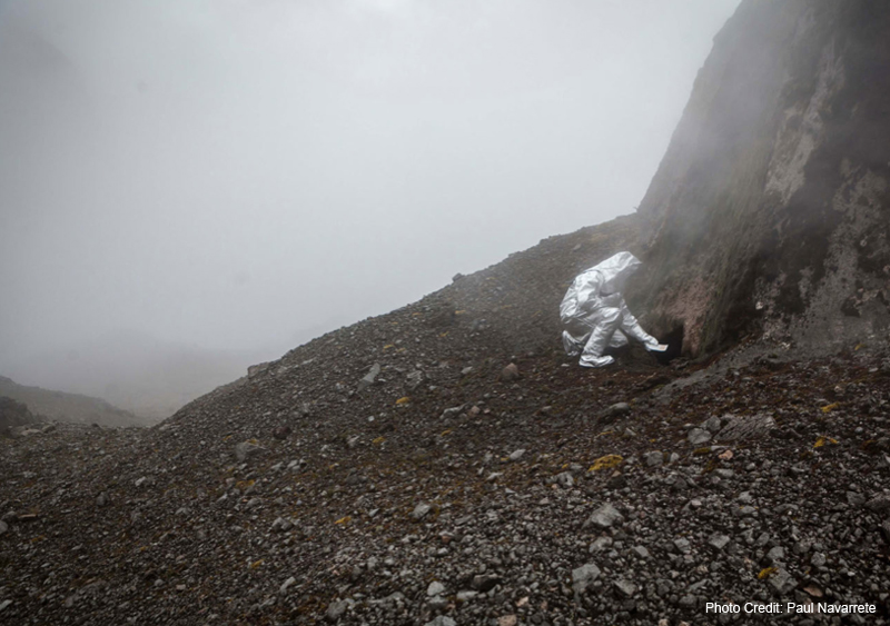
Man visiting a volcano

Eduardo Navarro – Poema Volcánico – 2014

“Returning to the execution of his artistic endeavor, Navarro revisited the Instituto Geofísico to speak further with Silvana, who was crucial in the process. When Navarro raised the question, “How can I make the volcano draw?,”  Silvana suggested the possibility of using litmus paper to react to the sulfur. Navarro immediately loved this idea, and started working with using litmus paper to create a machine that would allow the volcano’s energy to leave a trail. The result was a hand-made frame that acted as a rack for the sheets of litmus paper, which fit inside a custom woven basket that he worked closely with local artisans to create. Navarro wore the basket like a backpack during his trek, and eventually lowered it into the fumarole. He then left it down there for one hour, providing the volcano with a chance to leave its mark and express itself as if typing on a PH-reactive typewriter (example of result featured below – top right).

Ultimately Navarro titled this work Poema Volcánico because of the act of “handing the typewriter” over to the volcano. In other words, Navarro gave the volcano the power to express something that was not his interpretation of it.

To expand, it can be argued that Navarro gave true authorship to the volcano because he wasn’t attempting to control the project’s result. In fact, throughout the entire process, there was always the chance that the volcano and litmus paper wouldn’t have any real reaction at all. Even after months of preparation and two rigorous climbs, Navarro admitted that he was willing to accept any outcome. For Navarro, “it would have been fine if the volcano didn’t have anything to say.”

Setting himself apart from the many other talented artists who have been inspired by volcanoes throughout the centuries, Navarro’s intention was to transform the volcano from subject into artistic collaborator. Navarro does not claim that the volcano is necessarily the author of this work, nor that he himself is the author of this work. To Navarro, Poema Volcánico is about how well he and the volcano know each other.” [credit]
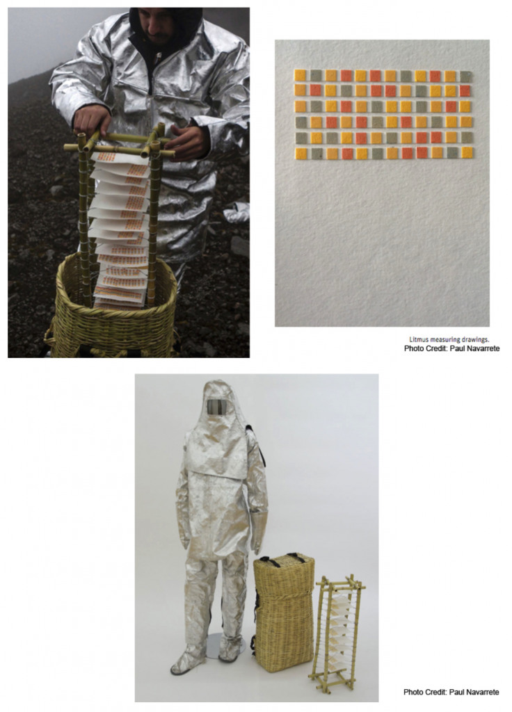
images explaining the volcano drawing process

Eduardo Navarro – Poema Volcanico 2014

Larsen Husby, Long Trace of Minneapolis (2016-18)

//longtraceofminneapolis.com/

Turkeys crossing Stinson Blvd

Larsen Husby “Turkeys crossing Stinson Blvd”

Watch video footage via MN Originals

“On October 3rd, 2016, I [Larsen Husby] decided to walk every street in Minneapolis. The parameters of this undertaking were as follows:

  • I must walk the entire length of every street within the city limits of Minneapolis, with the exception of streets which do not allow pedestrians, such as interstates and private streets.
  • Every walk must start with the intention of being a walk for the sake of the project; intention may not be applied retroactively.
  • I must record the route, length, and duration of every walk; however, failure to record one aspect of a walk does not disqualify it from counting towards the ultimate goal.

Following these rules, I walked 1,315 miles, finishing on June 26th, 2018.

The title, Long Trace of Minneapolis, addresses two crucial aspects of the work. ‘Trace’ refers to the piece as an act of drawing: my feet are a pencil, drawing invisible lines across the city. If one could see them, these lines would add up to form a trace of the entire street network, a map of Minneapolis the size of Minneapolis. ‘Long’ describes the temporal nature of the piece, which is a lived experience, not an object.  Those invisible lines are drawn not only along the ground, but through minutes, hours, and days.

This website is a document of the piece. It contains records of the project in the form of maps, photographs, measurements, and written reflections.”

Rachael Clewlow “Explorer” 2011

[credit]

“Rachael Clewlow meticulously documents the ways in which she inhabits the city in which she lives: the routes she takes through it, the times and dates of her travels, and the methods by which (to paraphrase Warhol) she moves from A to B and back again.

Several of the artists in ‘Walk On’ use GPS technologies to monitor their own movements through space. Clewlow, by contrast, prefers what the writer Robert Macfarlane has punningly called “the old ways”: she keeps a series of “statistical diaries” in which routes, traditional pathways or not, are “logged, through dedicated, almost ritualistic daily recording”. These diaries are exquisite objects in their own right. They are also the source material for Clewlow·s pictorial inventions.

Like other artists here, Clewlow creates her own systems of translation by which the patterns of her own mobility become abstract patterns of form and color. She describes her process as “the organization and presentation of related data, accumulated over years” into abstract imagery which “recalls the visual language of maps and their color coding systems, though their graphic style belies the rigorous and precise handmade approach to making them”. Indeed, Clewlow plays with the idea that her works should be functional, deliberately making them lie on the borders of legibility. Her conceptual and material dexterity ensure that her works instigate journeys in our imaginations.”